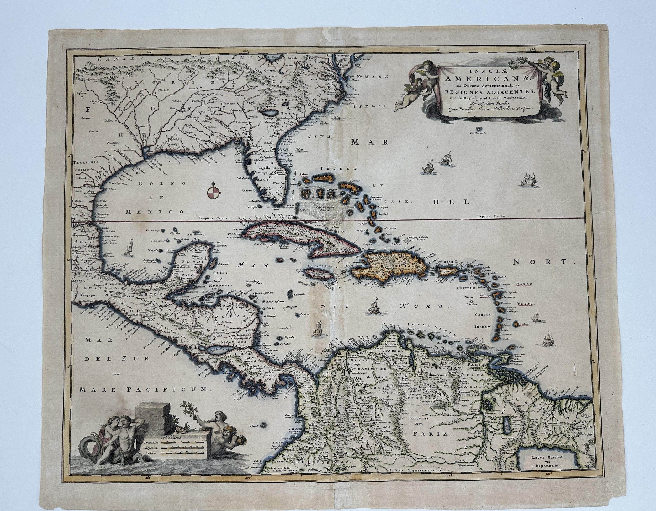
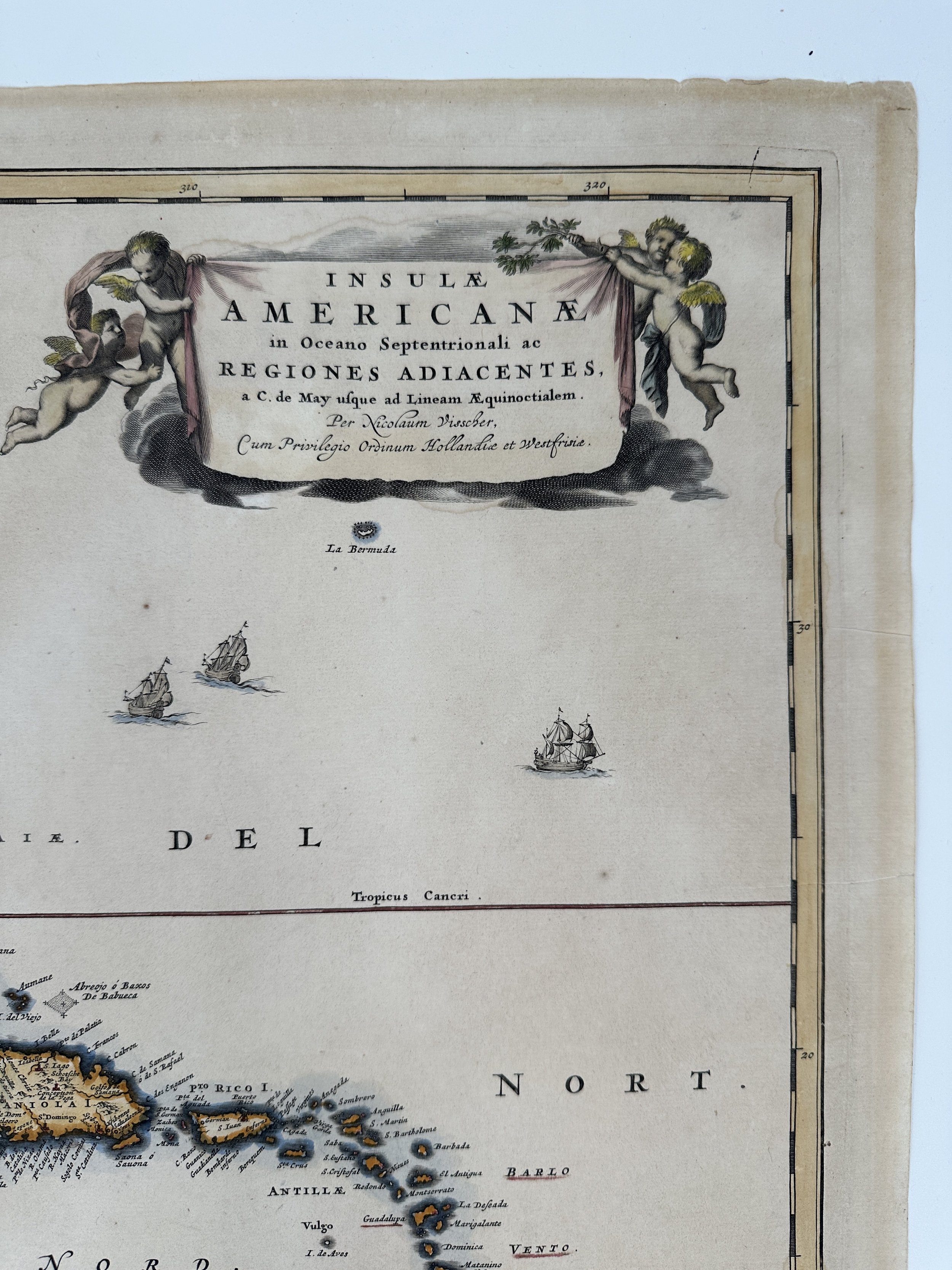
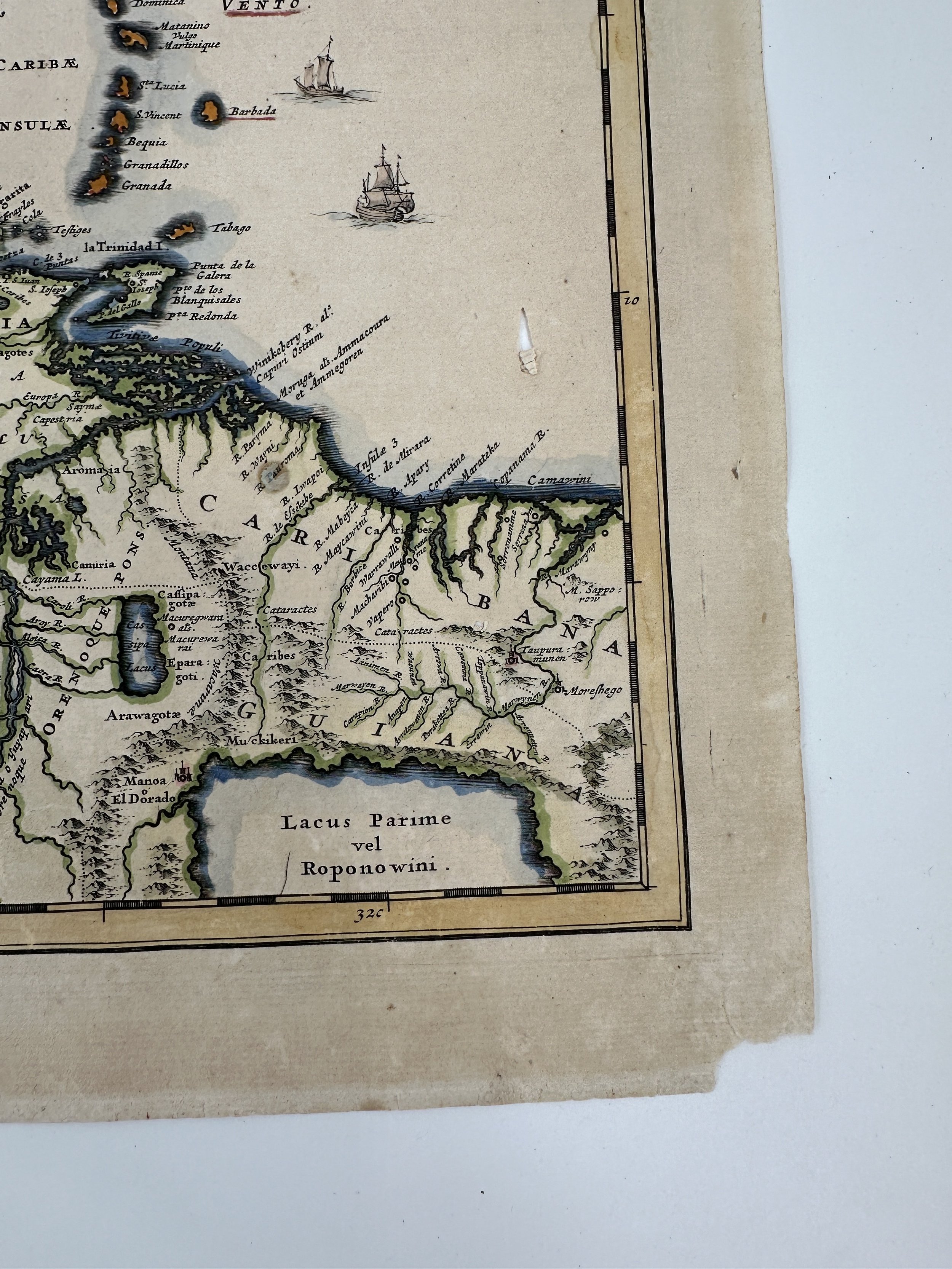
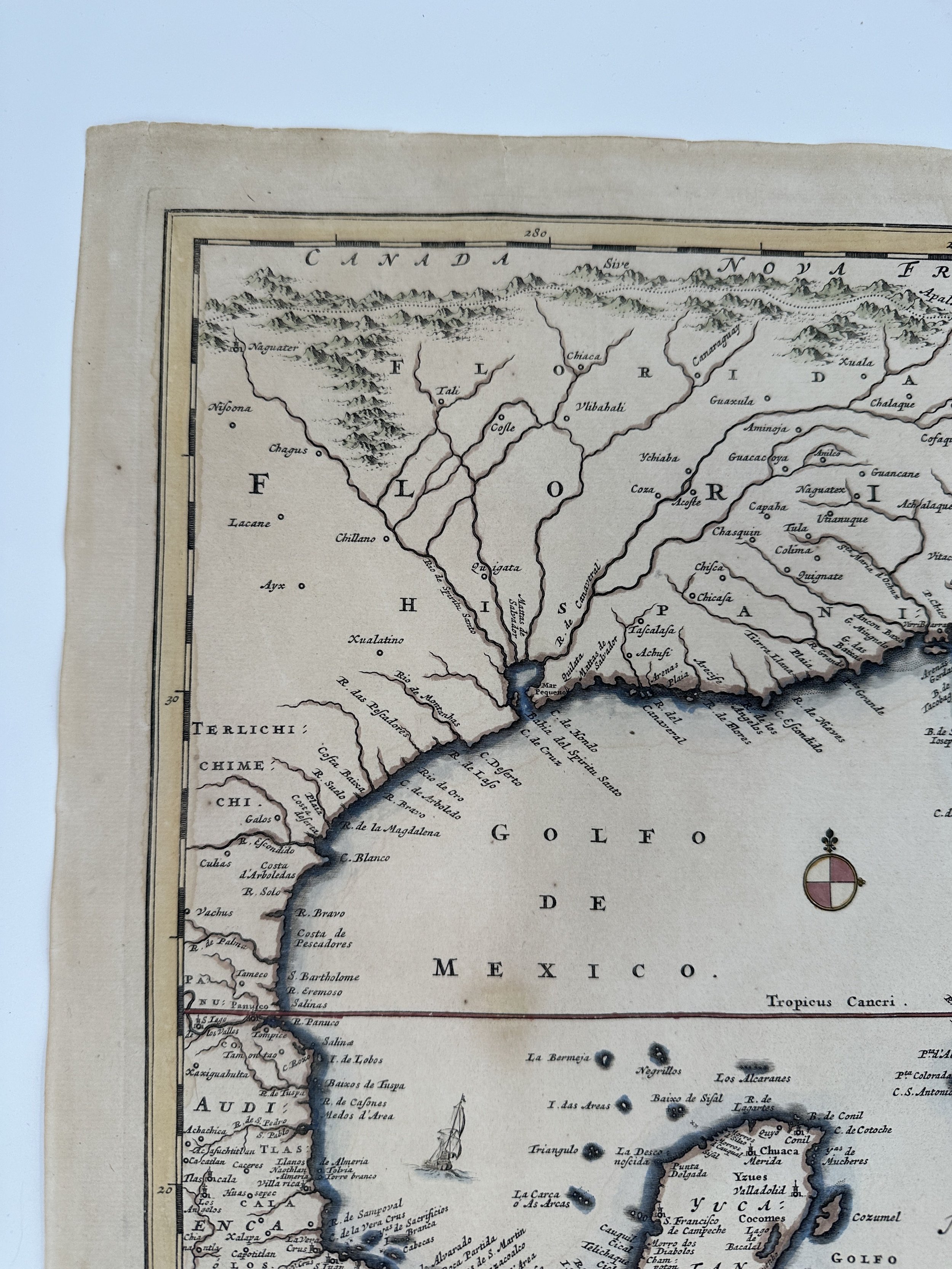
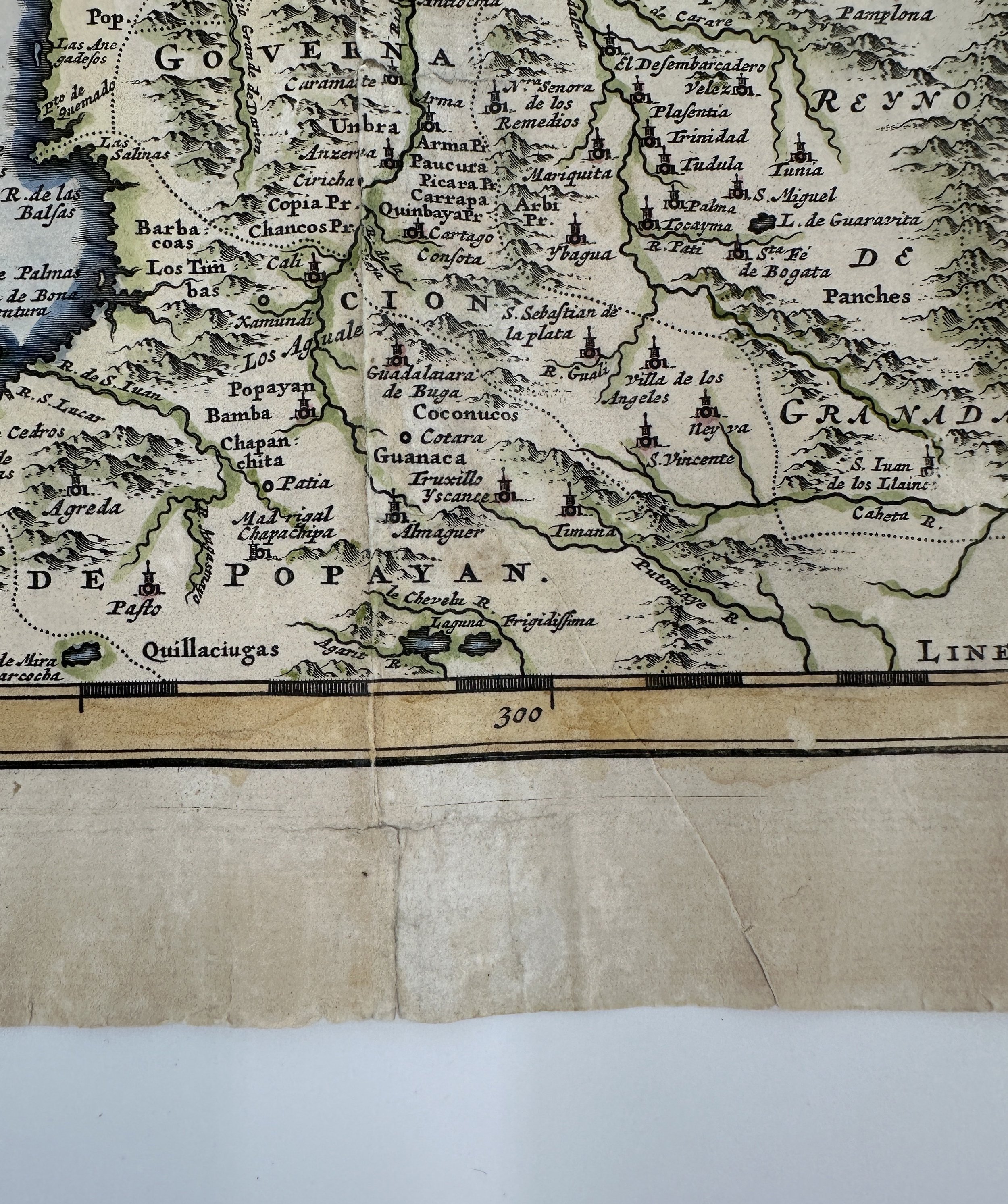
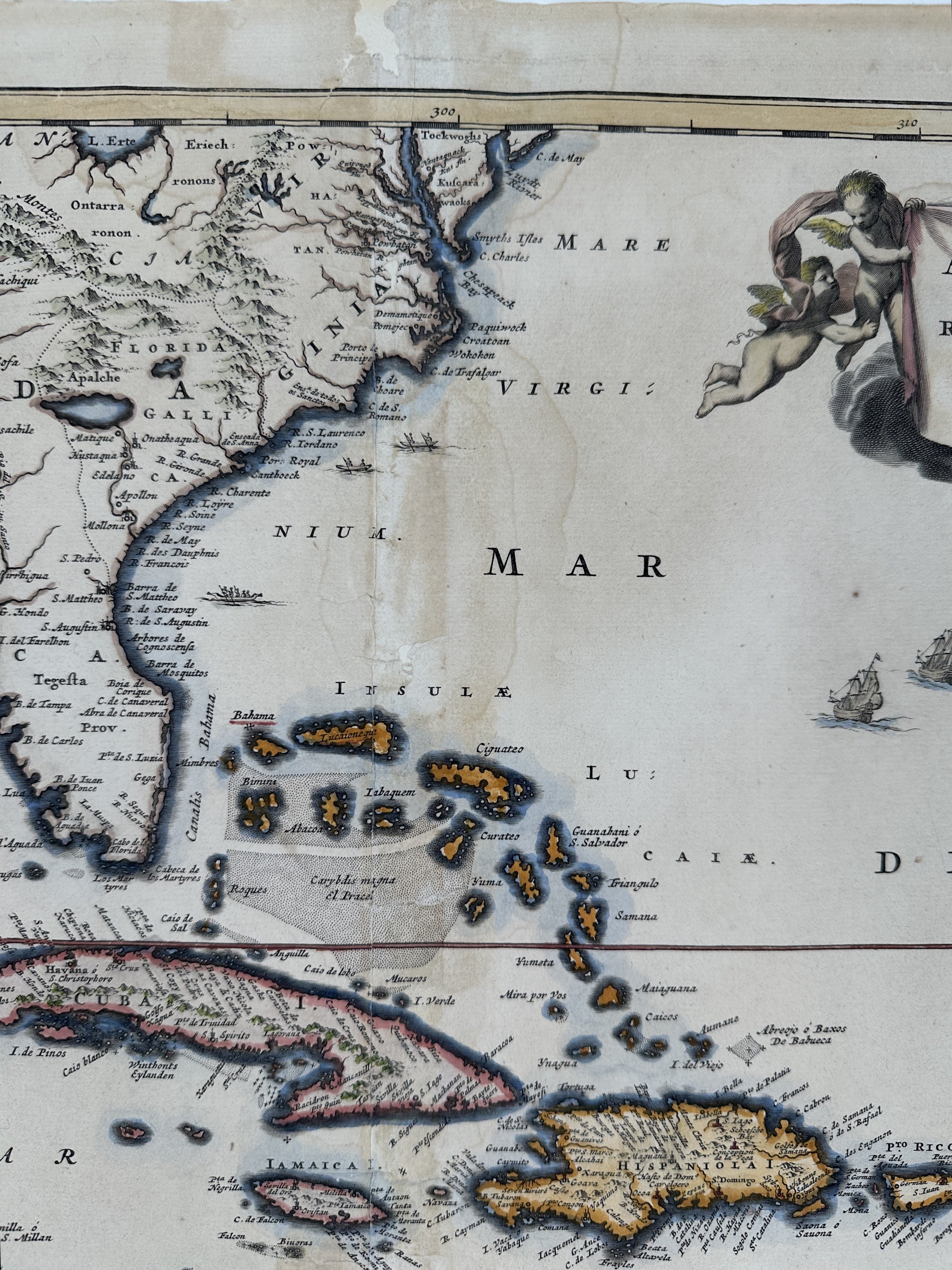
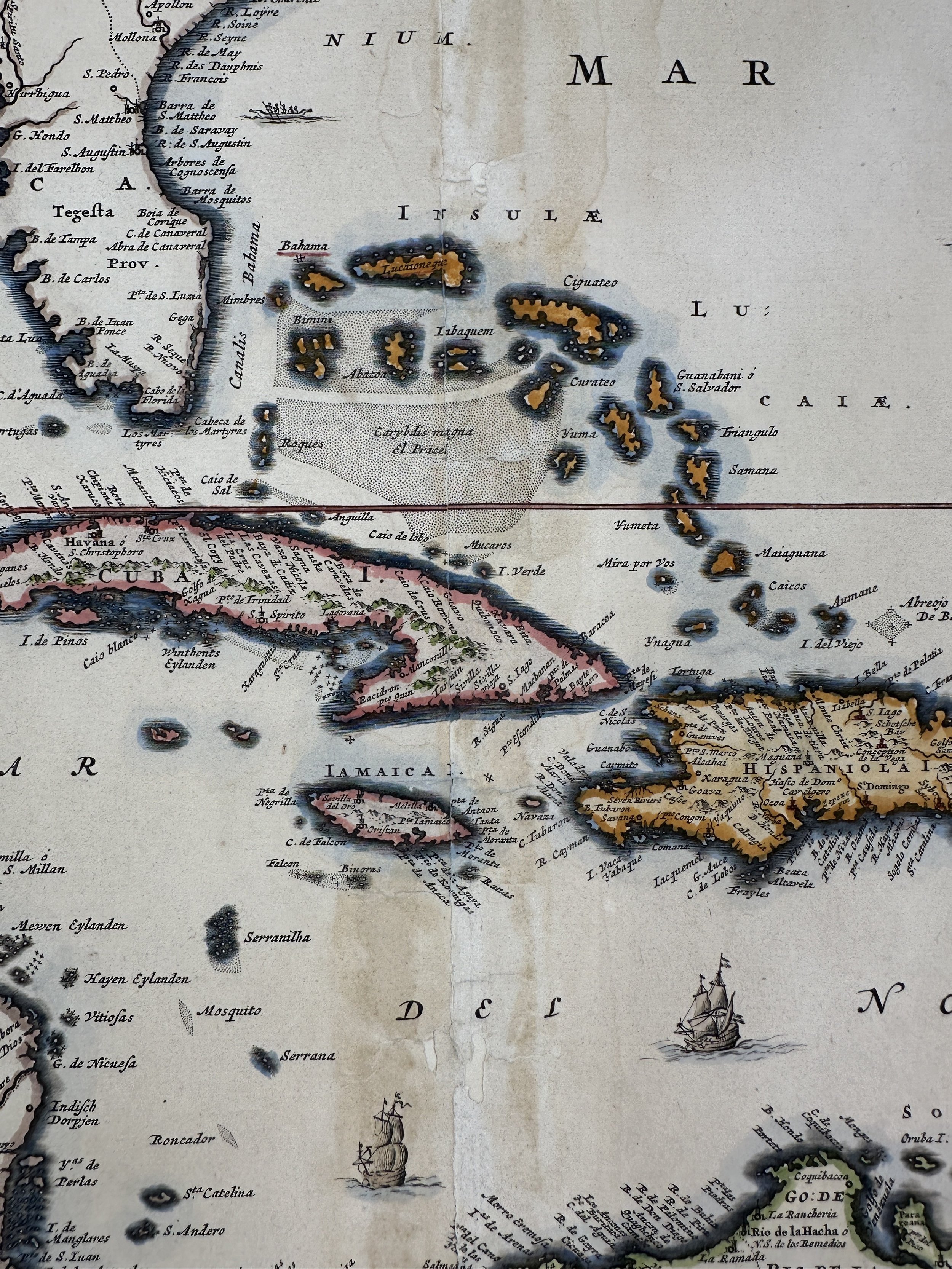
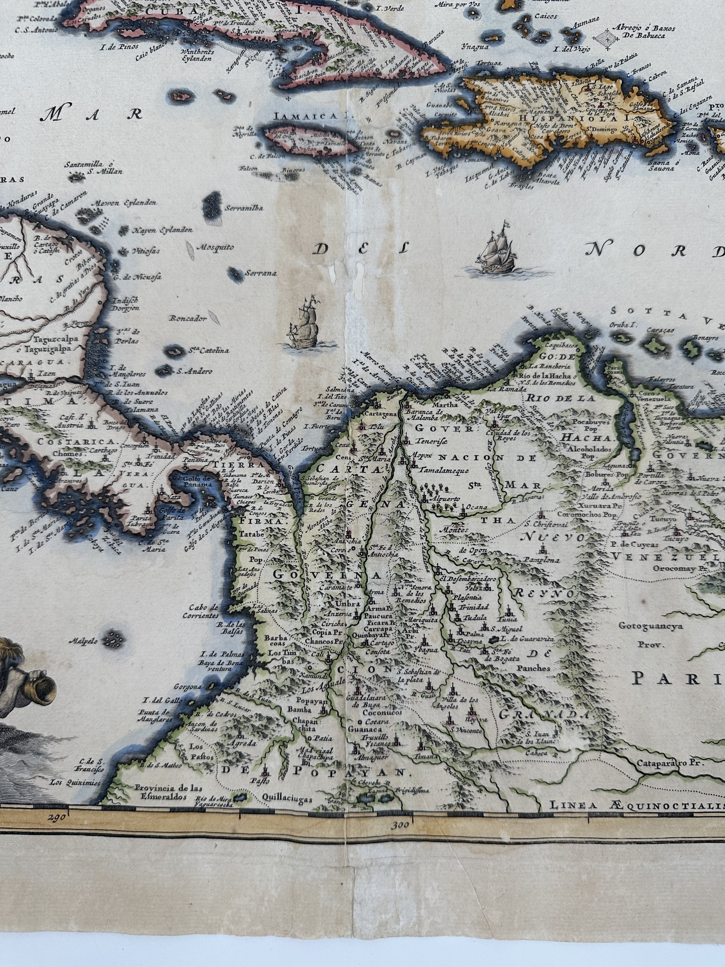
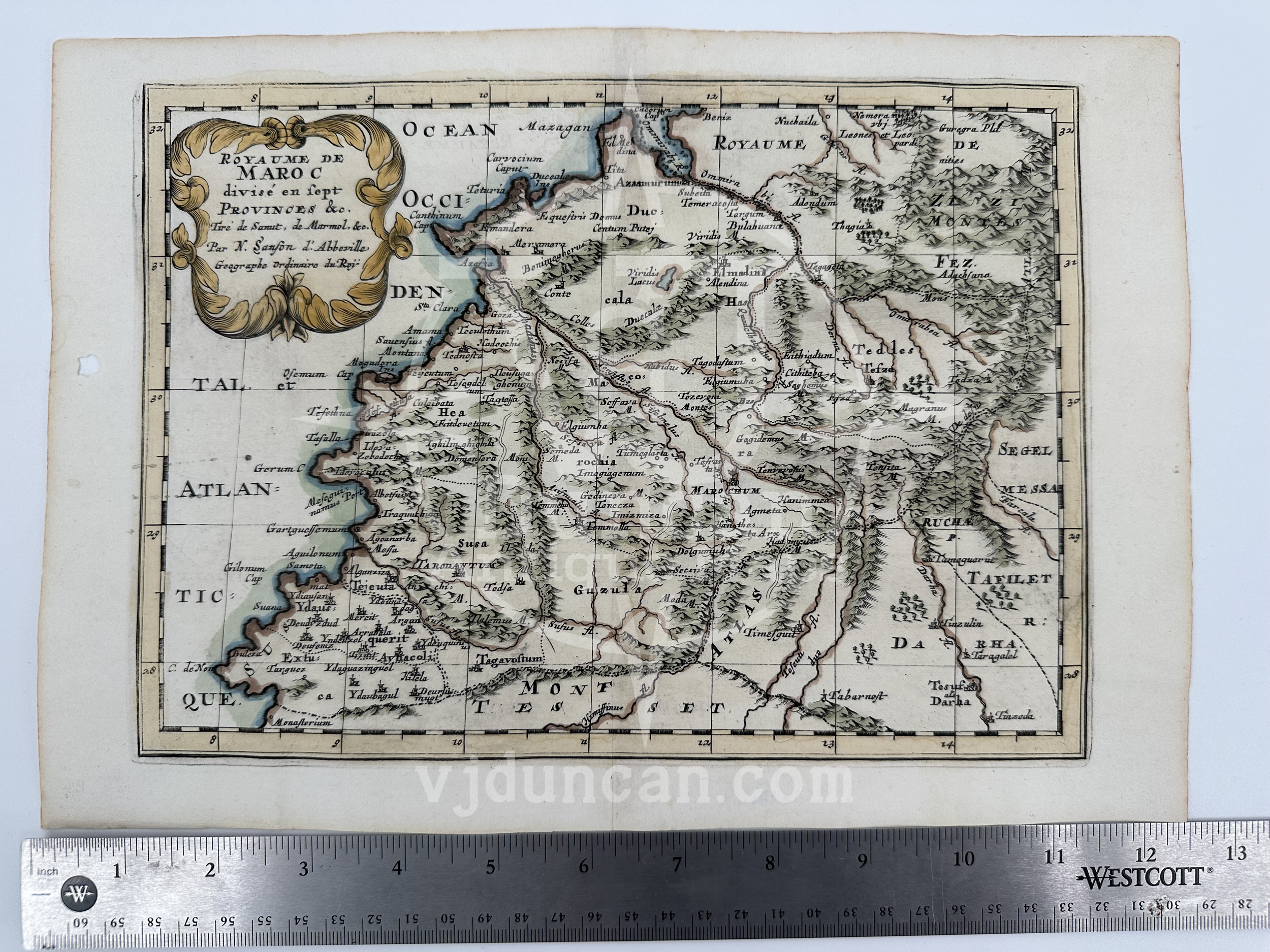
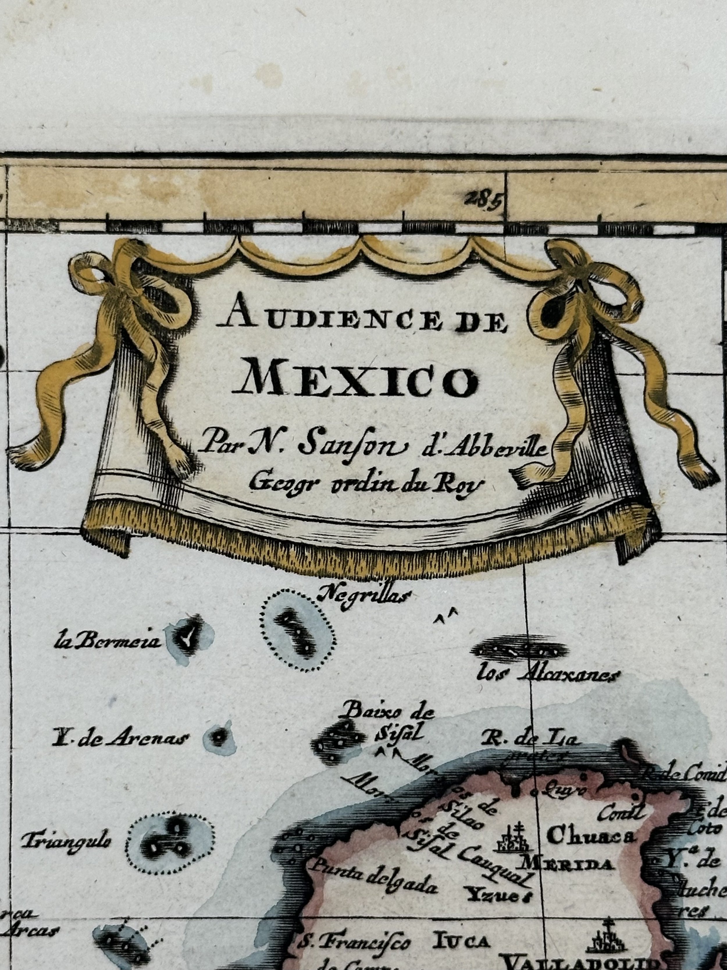
Rigobert Bonne 1787 Copper Engraving Map of India below the Ganges and the Island of Ceylon ( Sri Lanka ); specifically the Coromandel and Malabar coasts ( Carte de la Partie Inferierure de l'Inde en Deca du Ganges Contenant l'Isle de Ceylon les cotes de Malabar et de Coromandel ) WITH MODERN HAND COLOR
Original 1787 Copperplate Engraving, from Atlas de Toutes Les Parties Connues du Globe Terrestre
Map by Rigobert Bonne
Published by Guillaume Thomas François Raynal
Engraved by André.
Hand Colored by Historian and Professor John Duncan ( 1938-2022 )
THIS MAP IS MODERN HAND COLORED. THE PAGE IS ORIGINAL TO THE 1780S.
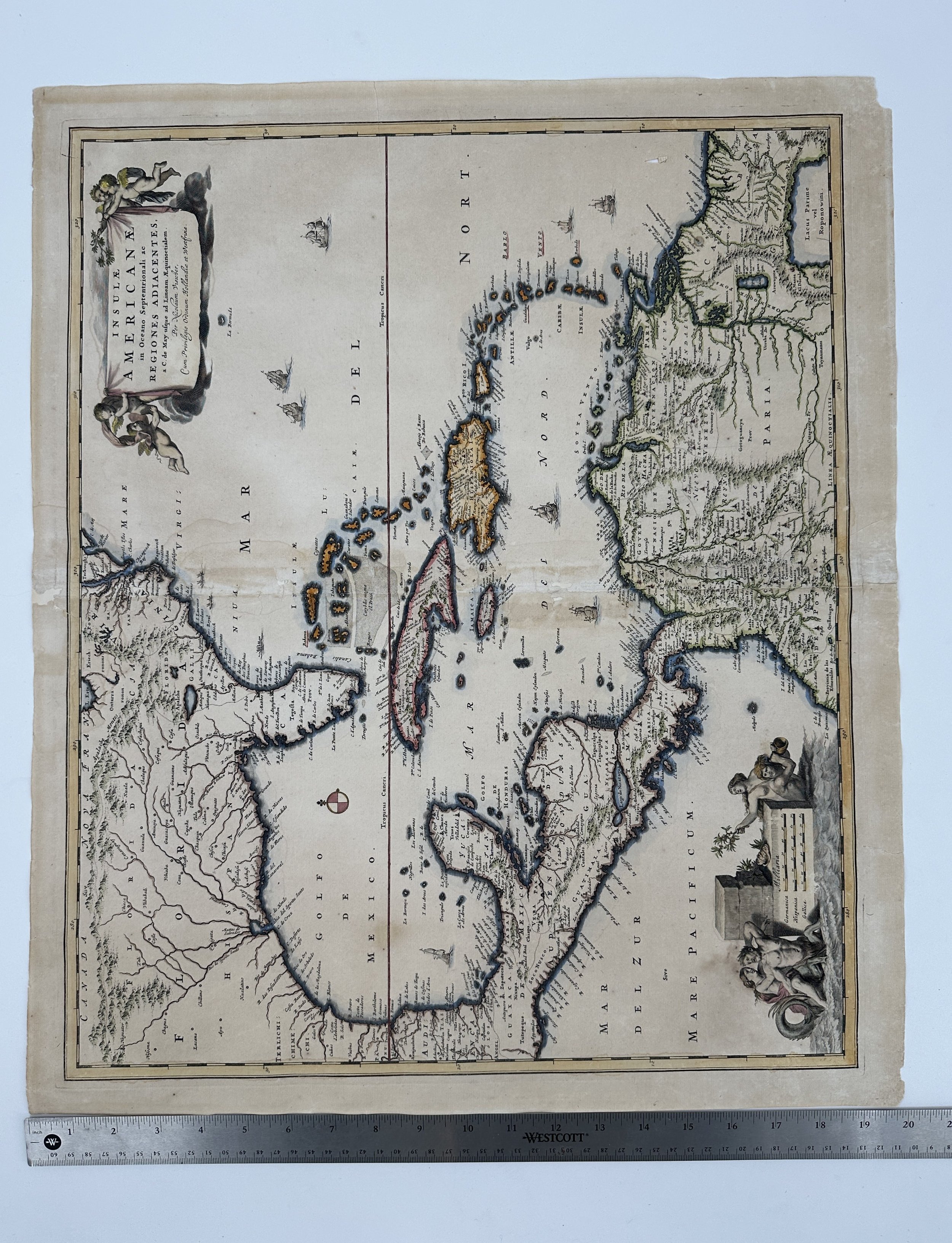
This map is not “new” or in “new condition.” This is an antique map and the quality of that will be reflected in the work. It was printed in 1787 and is in good condition considering its antique age. The full page measures approx. 14.25”L x 9.75”W and shows some signs of aging, particularly down the middle of the image ( due to its removal from the Atlas ). The edges of the map show light foxing.
The map pictured is the one that you will receive.
Born in Raucourt France on October 6th 1727, Rigobert Bonne was regarded as one of the most important and influential Cartographers of the 18th century. A mathematician turned Royal Cartographer and Hydrographer for the Depôt de la Marine, Bonne replaced Jacques Nicolas Bellin in 1773 and while a lot of their works shared similarities in the layout of the terrain, his maps were far more detailed and accurate than that of his predecessor. His work was popular for the minimalist, yet still elegant approach to his maps compared to the time, often using less color and forgoing the elaborate compass roses and decorative cartouches that could be seen in other cartographers’ work.
All items listed are from V&J Duncan in Savannah, GA. The shop began in 1983 with one tabletop of antique maps and has grown into a vast collection of old engravings, mezzotints, lithographs, photographs, old books, and antique prints. We have prints of architectural interest, birds, animals, botanicals, fashion, sporting scenes and tens of thousands of portraits. Our inventory also includes views and maps of Savannah and other cities, all U.S. states and most countries of the world. Visit us in Savannah, Georgia, or shop inventory here online.
All prints are rolled and shipped in a poster tube. Smaller prints will be shipped in a rigid media mail folder.
Rigobert Bonne 1787 Copper Engraving Map of India below the Ganges and the Island of Ceylon ( Sri Lanka ); specifically the Coromandel and Malabar coasts ( Carte de la Partie Inferierure de l'Inde en Deca du Ganges Contenant l'Isle de Ceylon les cotes de Malabar et de Coromandel ) WITH MODERN HAND COLOR
Original 1787 Copperplate Engraving, from Atlas de Toutes Les Parties Connues du Globe Terrestre
Map by Rigobert Bonne
Published by Guillaume Thomas François Raynal
Engraved by André.
Hand Colored by Historian and Professor John Duncan ( 1938-2022 )
THIS MAP IS MODERN HAND COLORED. THE PAGE IS ORIGINAL TO THE 1780S.
This map is not “new” or in “new condition.” This is an antique map and the quality of that will be reflected in the work. It was printed in 1787 and is in good condition considering its antique age. The full page measures approx. 14.25”L x 9.75”W and shows some signs of aging, particularly down the middle of the image ( due to its removal from the Atlas ). The edges of the map show light foxing.
The map pictured is the one that you will receive.
Born in Raucourt France on October 6th 1727, Rigobert Bonne was regarded as one of the most important and influential Cartographers of the 18th century. A mathematician turned Royal Cartographer and Hydrographer for the Depôt de la Marine, Bonne replaced Jacques Nicolas Bellin in 1773 and while a lot of their works shared similarities in the layout of the terrain, his maps were far more detailed and accurate than that of his predecessor. His work was popular for the minimalist, yet still elegant approach to his maps compared to the time, often using less color and forgoing the elaborate compass roses and decorative cartouches that could be seen in other cartographers’ work.
All items listed are from V&J Duncan in Savannah, GA. The shop began in 1983 with one tabletop of antique maps and has grown into a vast collection of old engravings, mezzotints, lithographs, photographs, old books, and antique prints. We have prints of architectural interest, birds, animals, botanicals, fashion, sporting scenes and tens of thousands of portraits. Our inventory also includes views and maps of Savannah and other cities, all U.S. states and most countries of the world. Visit us in Savannah, Georgia, or shop inventory here online.
All prints are rolled and shipped in a poster tube. Smaller prints will be shipped in a rigid media mail folder.

 Image 1 of 6
 Image 2 of 6
 Image 3 of 6
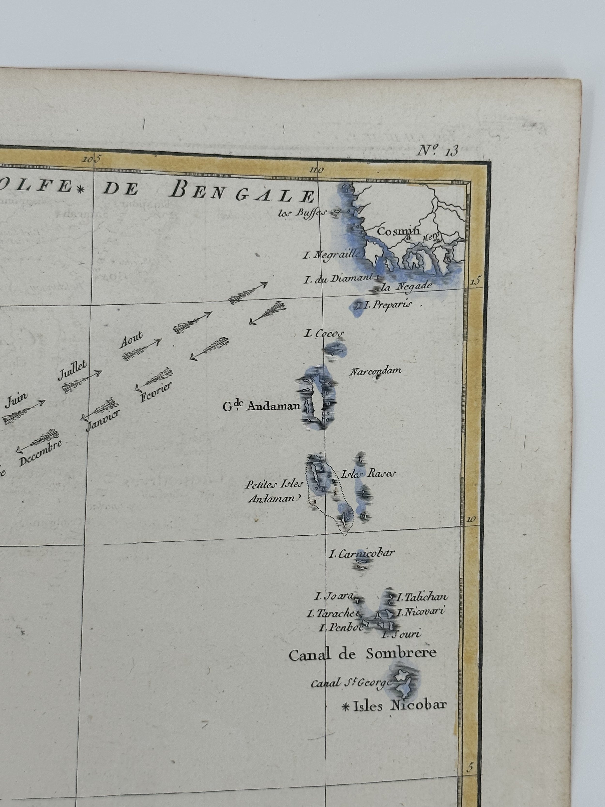 Image 4 of 6
 Image 5 of 6
 Image 6 of 6