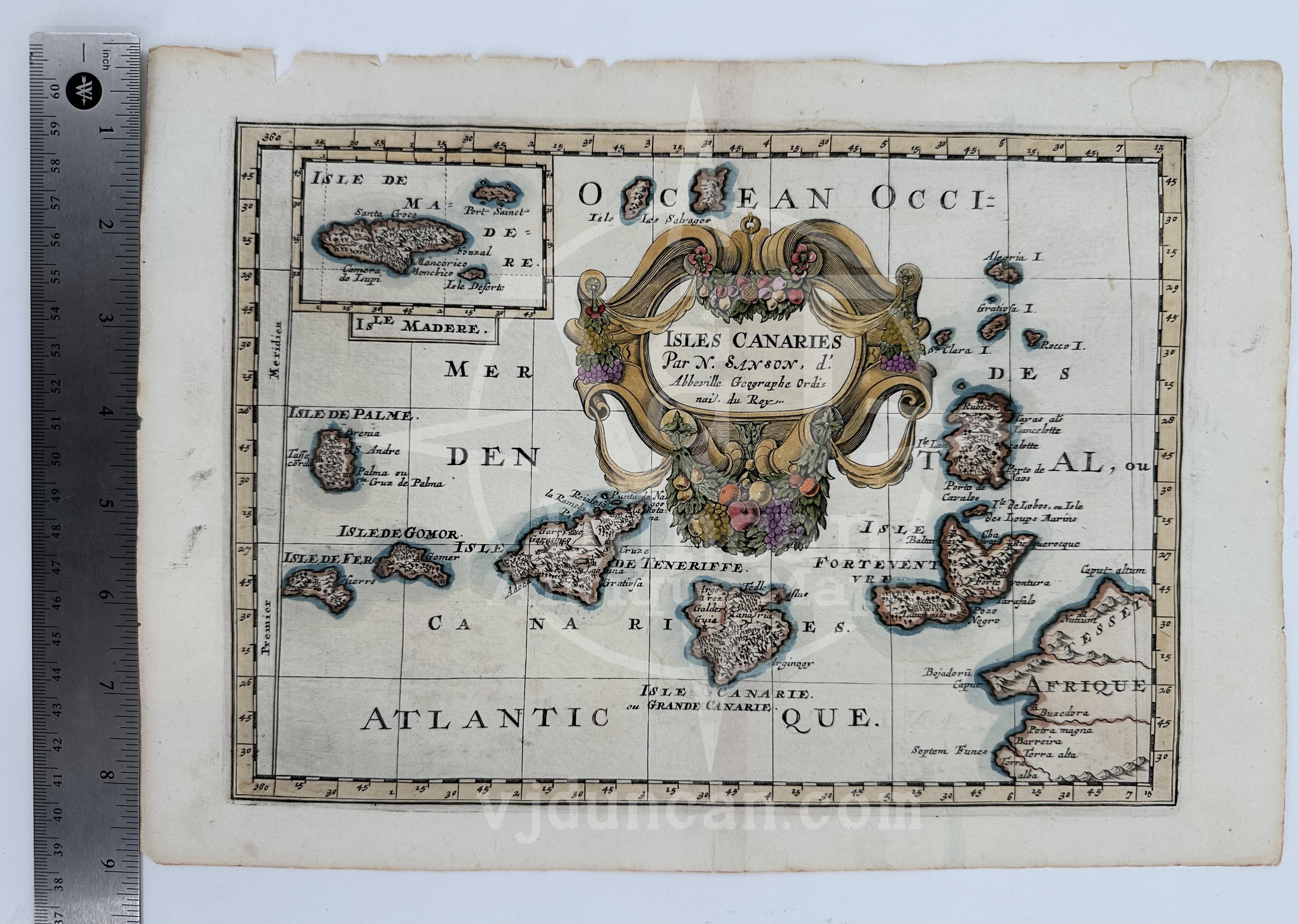
Image 1 of 3
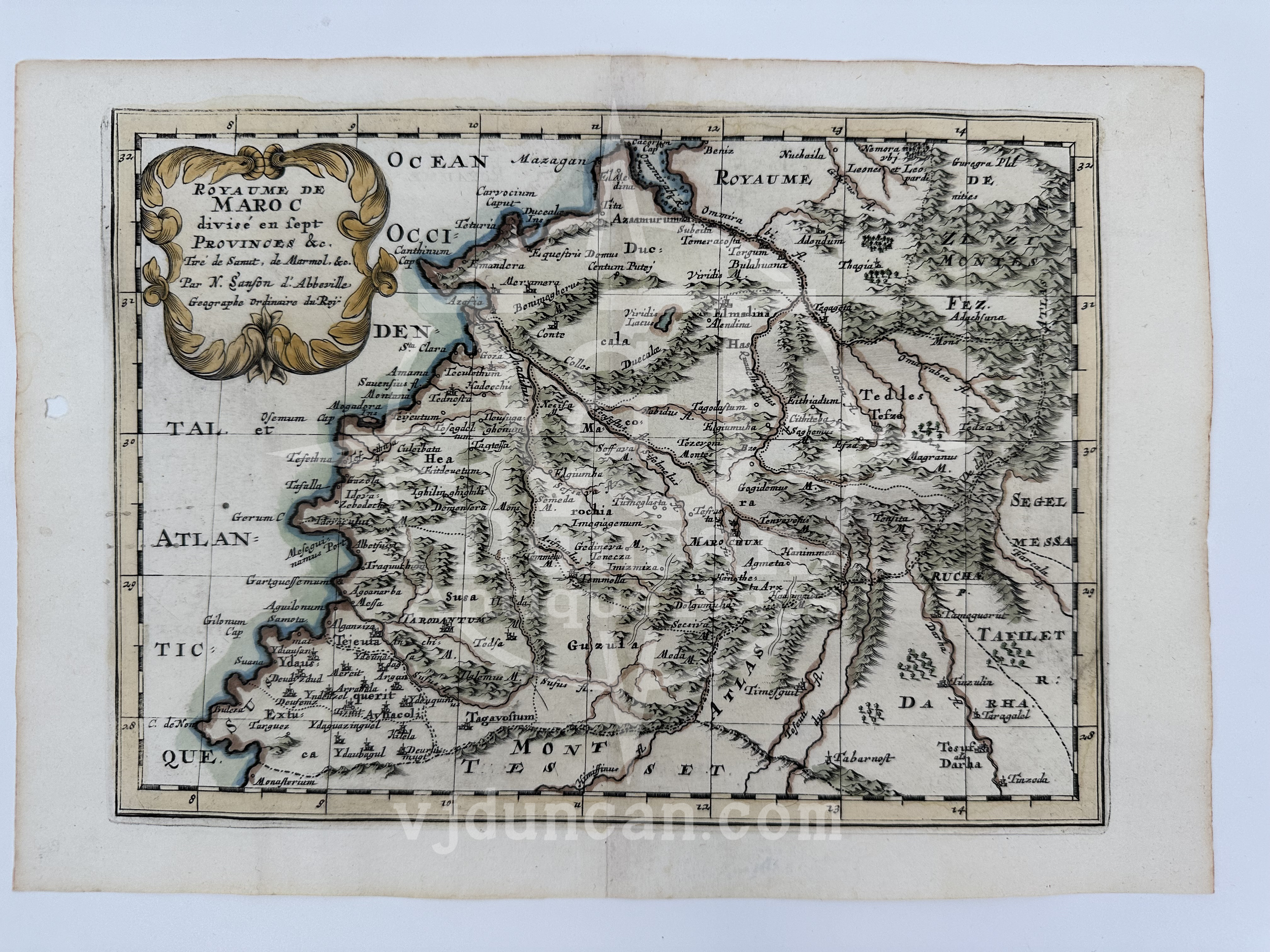
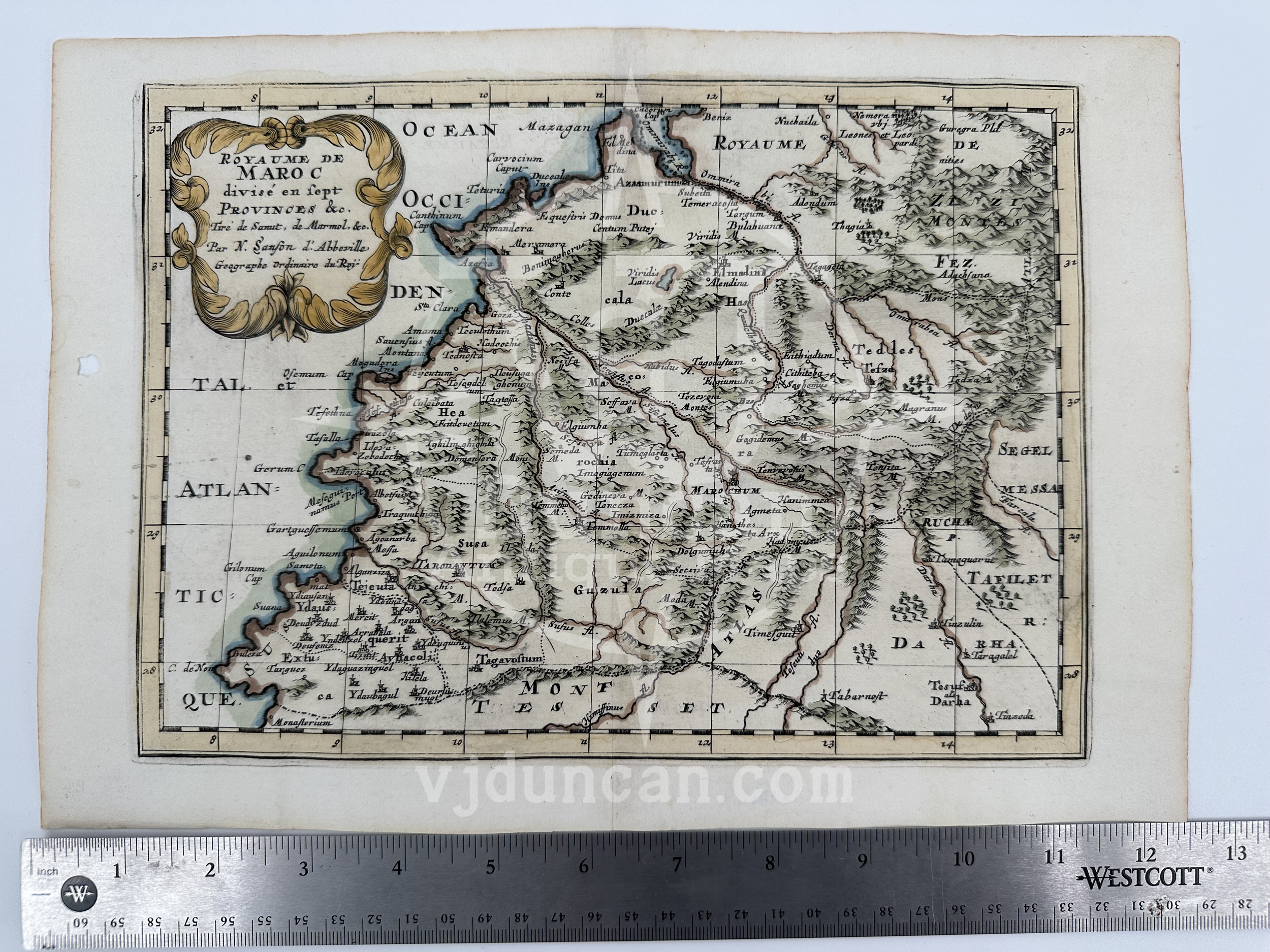
 Image 2 of 3
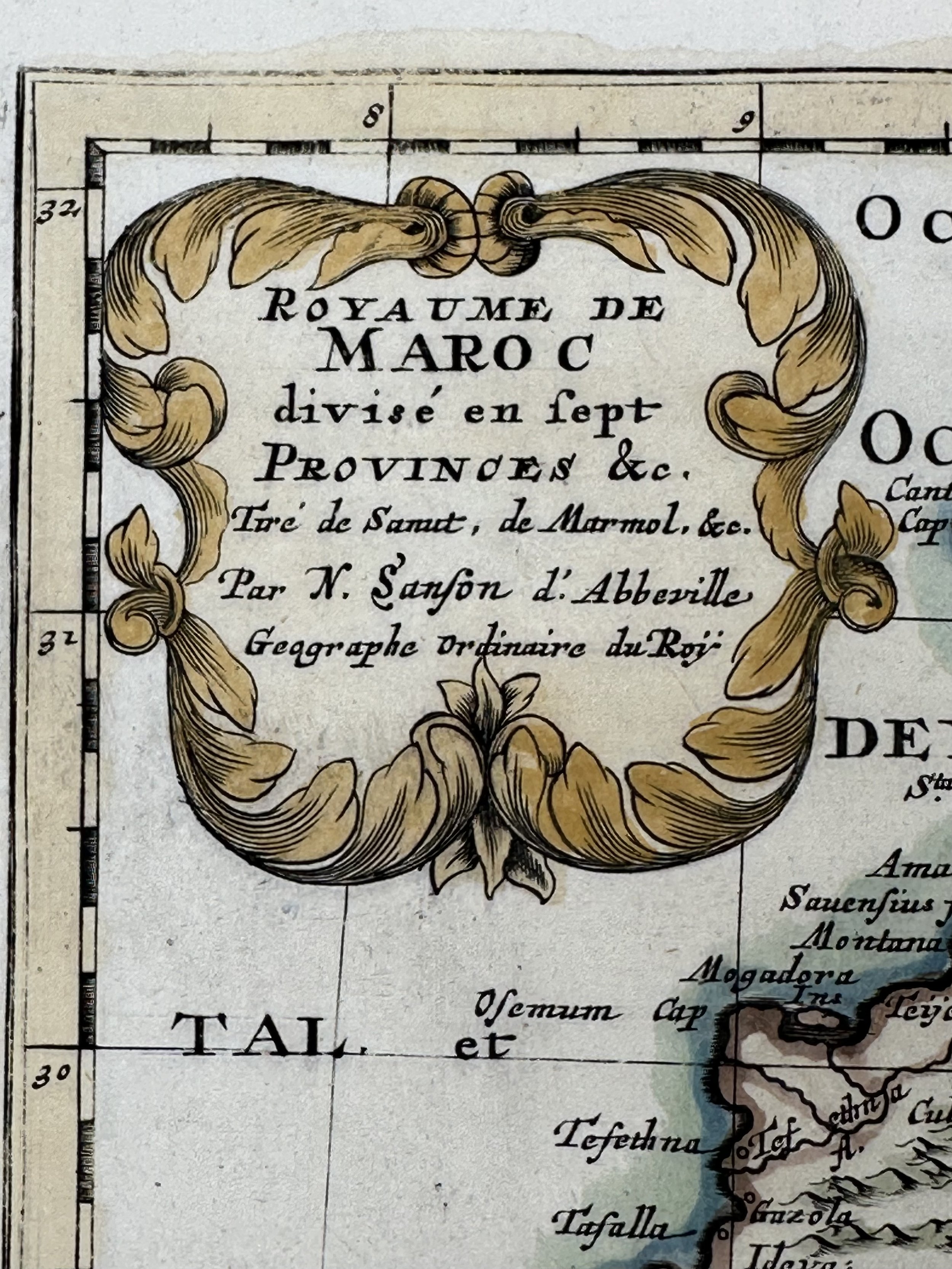
 Image 3 of 3
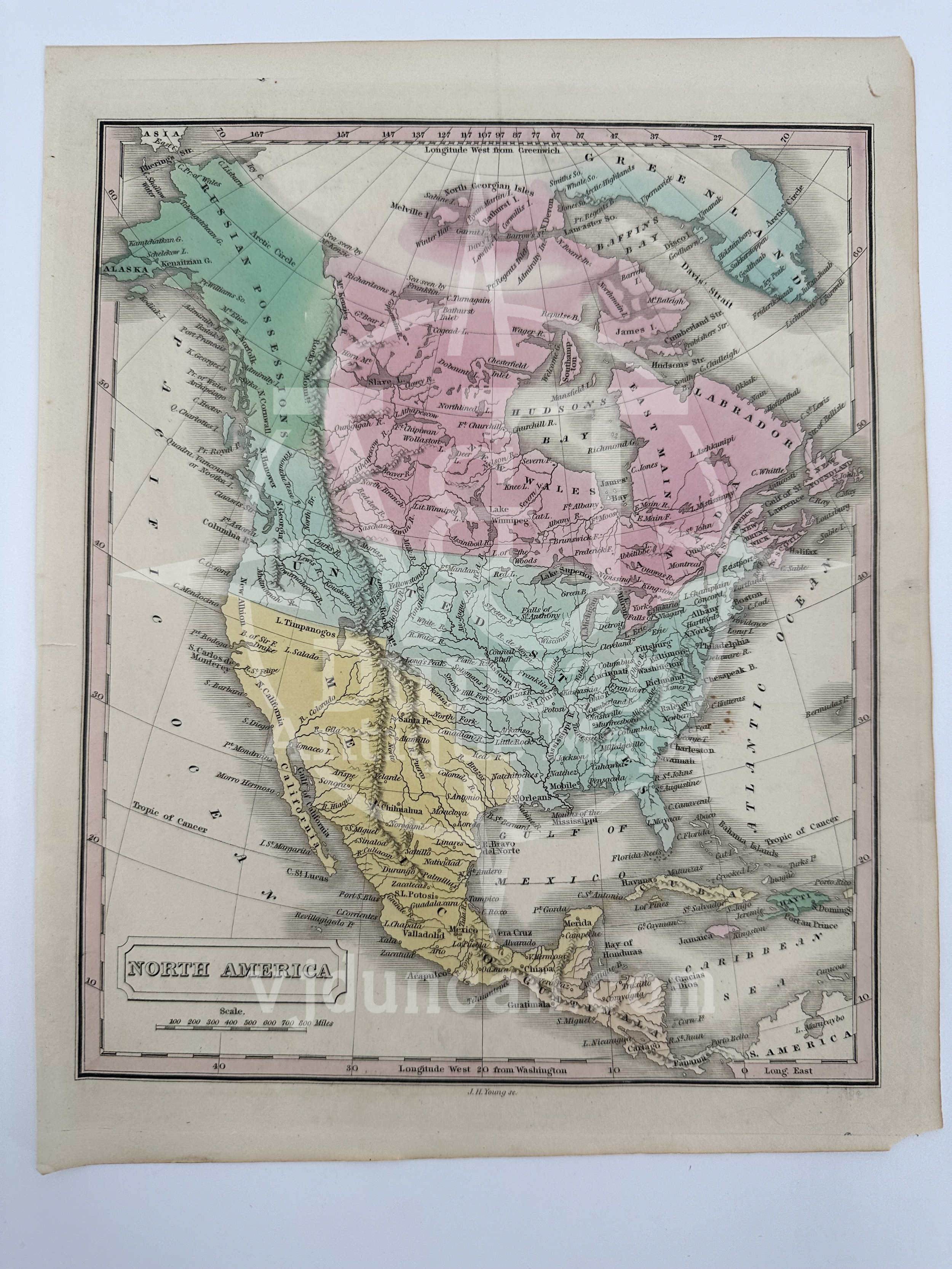
Gray’s Atlas Authentic Map Of Kentucky and Tennessee 1873.
This Map was removed from a 1873 “Gray's Atlas of the United States with General Maps of the World” by O.W. Gray, a Civil and Topographical Engineer. The map was hand colored.
O. W. Gray was a publishing firm based in Philadelphia. Later, they published as O. W. Gray & Son. They published atlases in the late nineteenth century.
The page is approx. 17”L x14”W and in the detail photo is the year when the map was entered to the library of congress. This map is not “new” or in “new” condition. It was printed in 1873 and is in excellent condition considering the antique age. The map pictured is the map you will receive.
All items in my shop are authentic originals unless otherwise stated.
Please visit this page for many listings including 1760's - 1960's, rare civil war period, state & territory maps, advertisements, etchings, and more.
All items listed are from V&J Duncan in Savannah, GA. The shop began in 1983 with one tabletop of antique maps and has grown into a vast collection of old engravings, mezzotints, lithographs, photographs, old books, and antique prints. We have prints of architectural interest, birds, animals, botanicals, fashion, sporting scenes and tens of thousands of portraits. Our inventory also includes views and maps of Savannah and other cities, all U.S. states and most countries of the world. Visit us in Savannah, Georgia, or shop inventory here online.
All maps are shipped securely is a Mailing Tube. Smaller maps may be shipped in a rigid flat mailer.