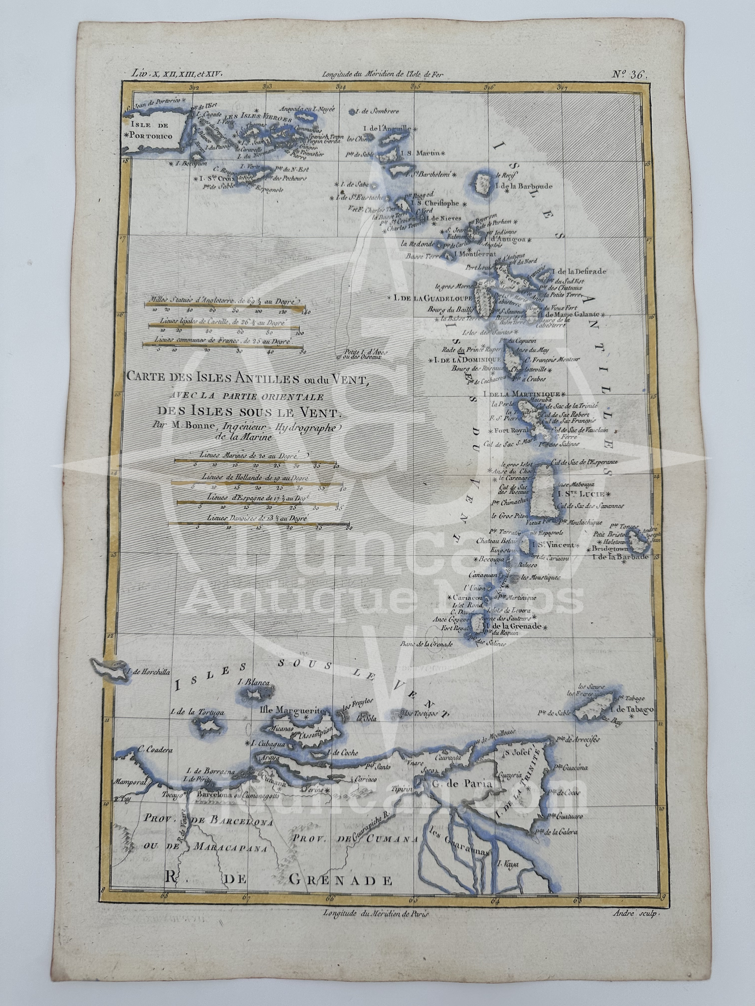
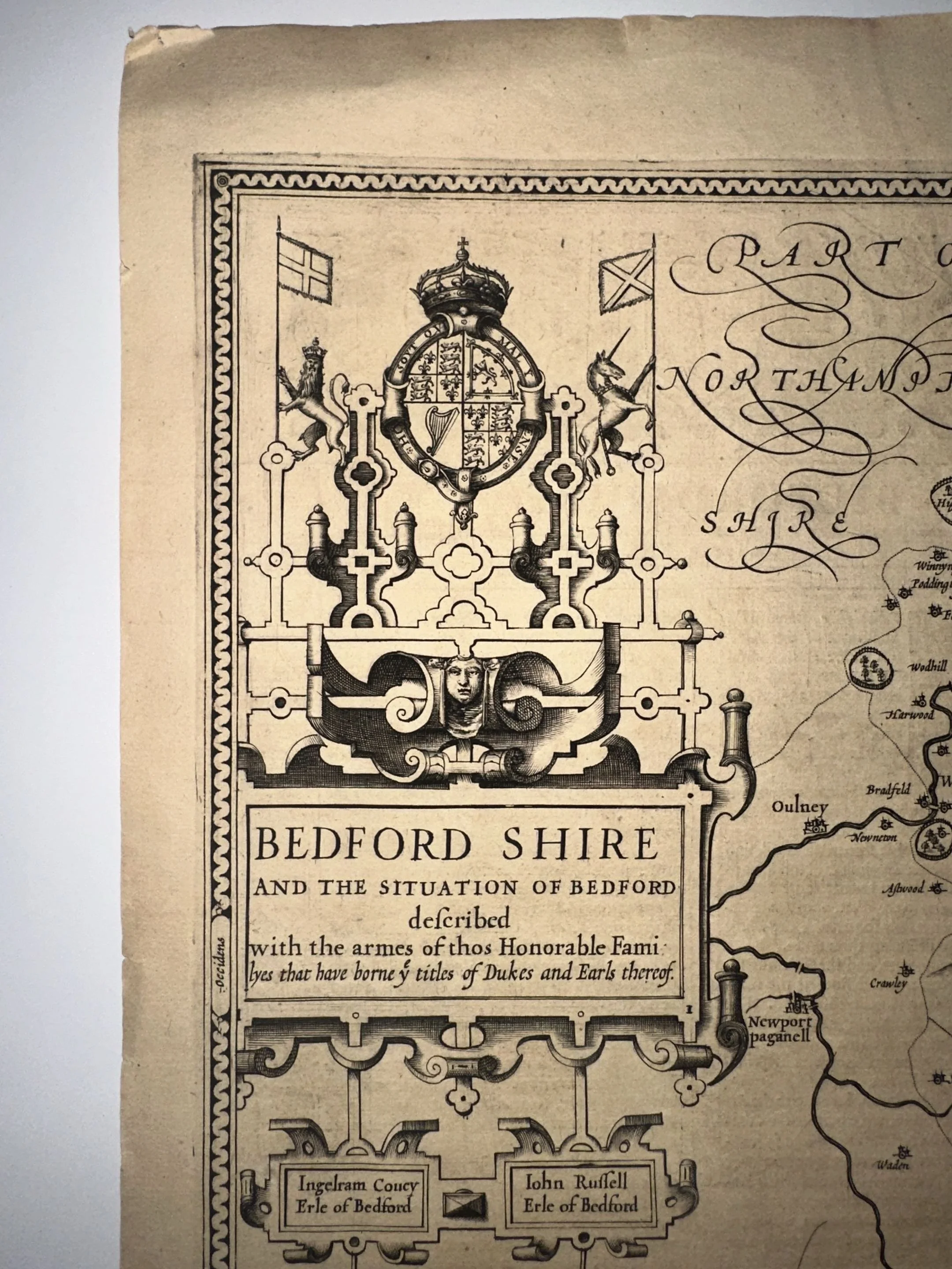
NICOLAES VISSCHER 1680 Insulae Americanae in Oceano Septentrionali ac Regiones Adiacentes ( The Caribbean, Florida, Southern US Central America, and part of South America ) Original Hand Colored Engraving
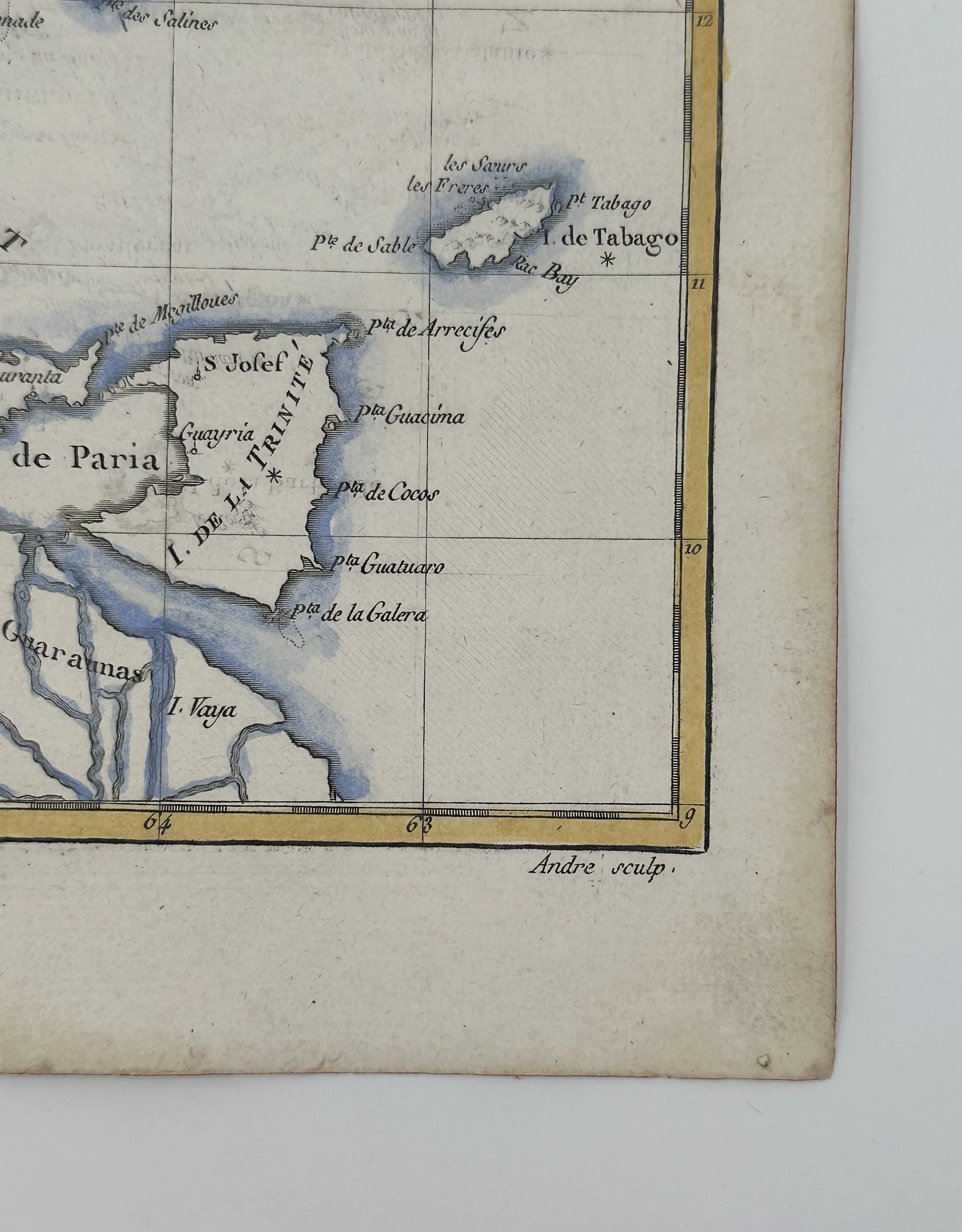
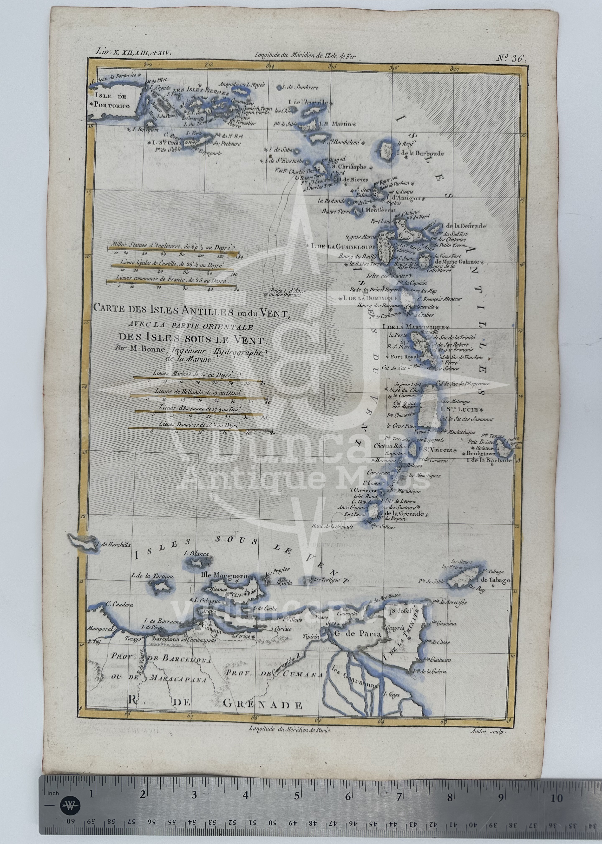
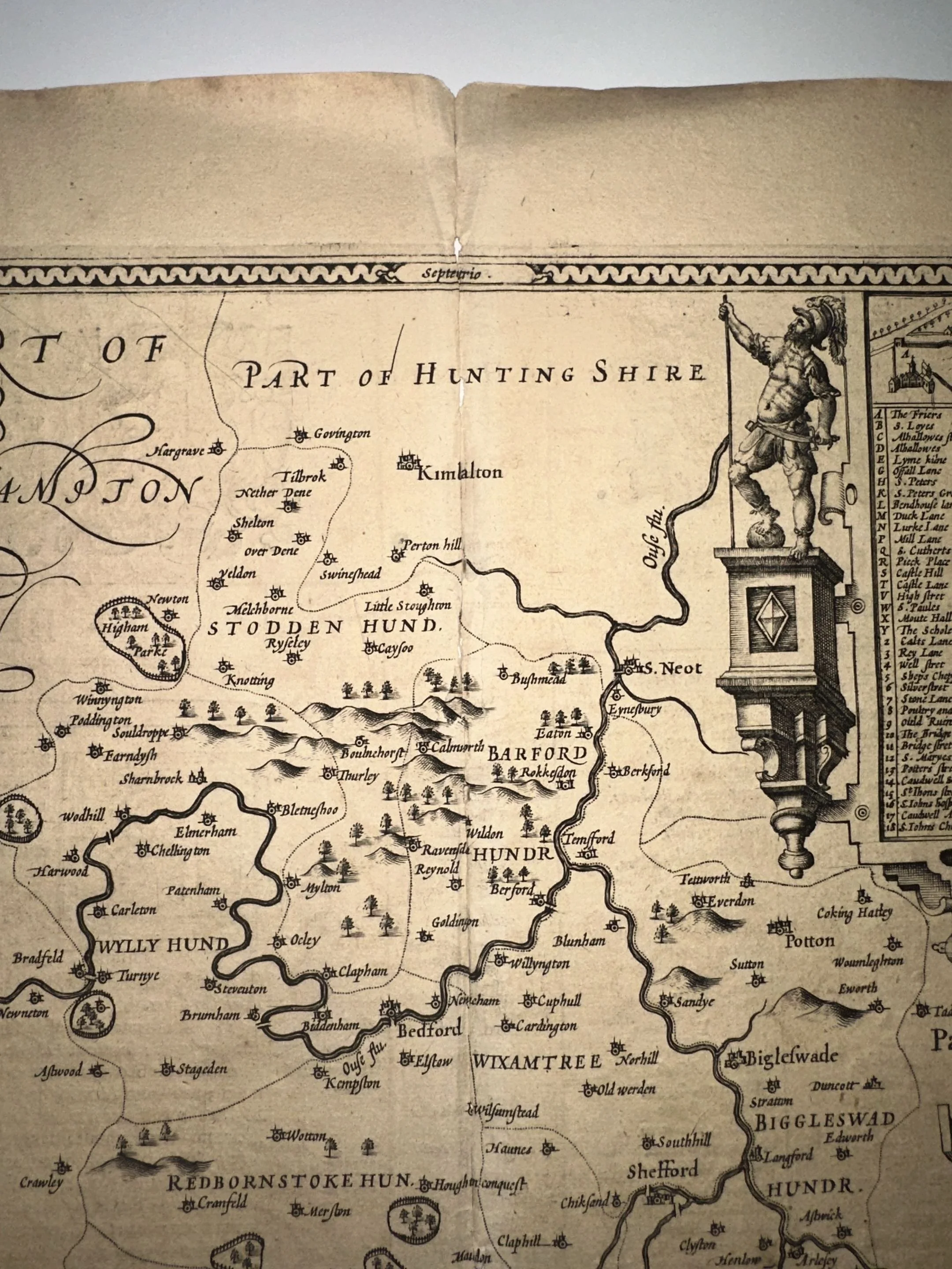
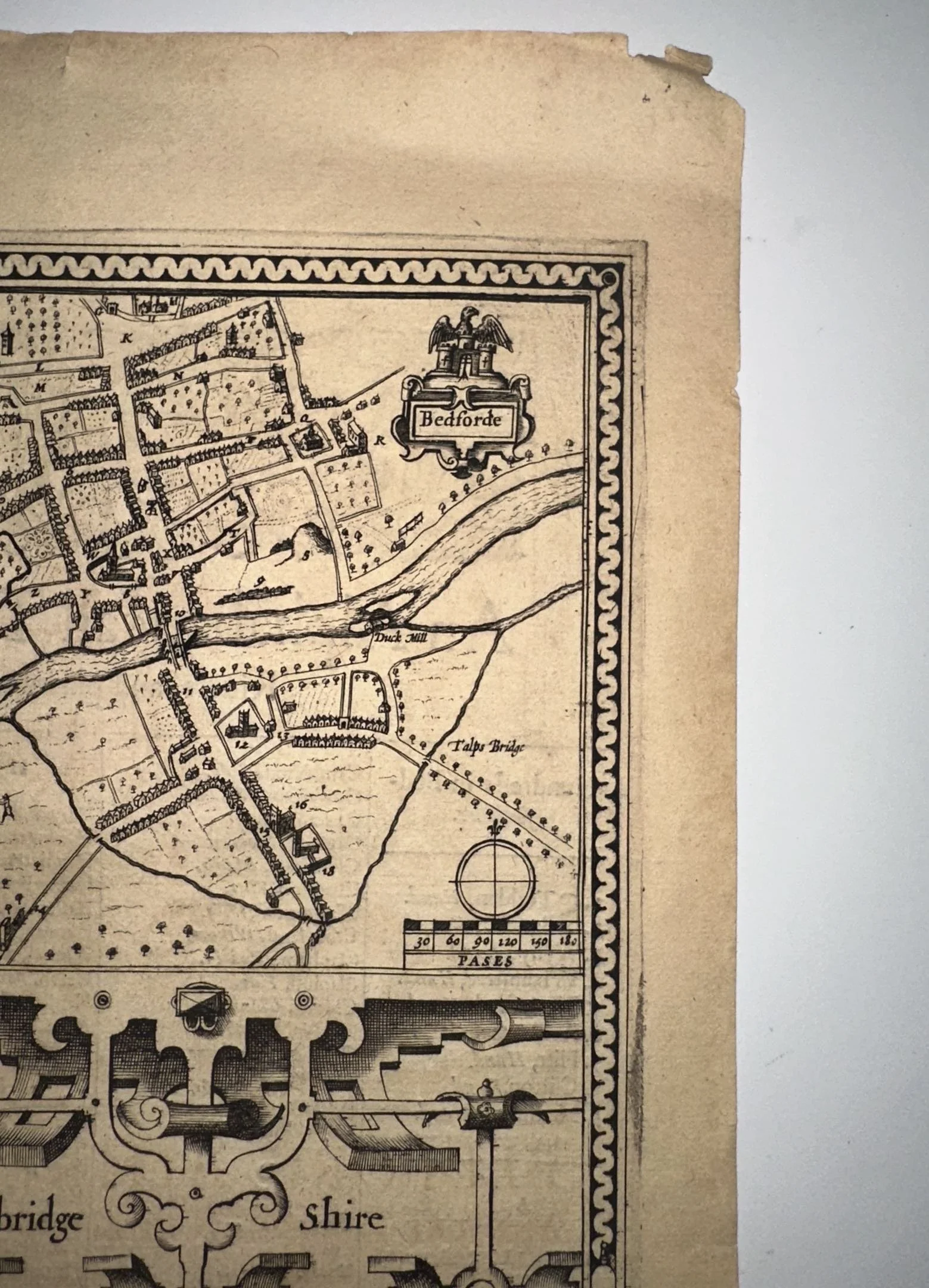
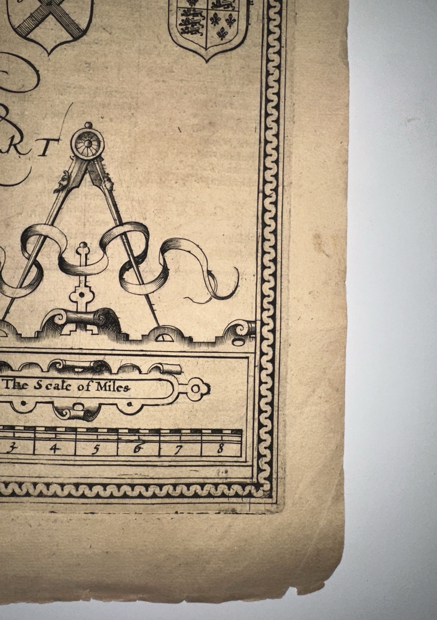
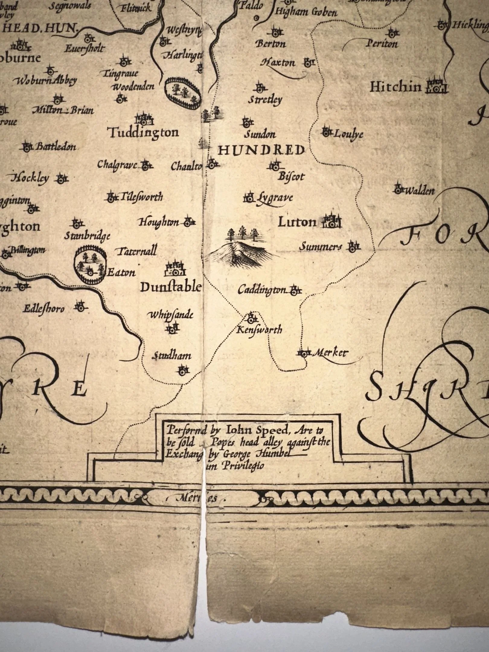
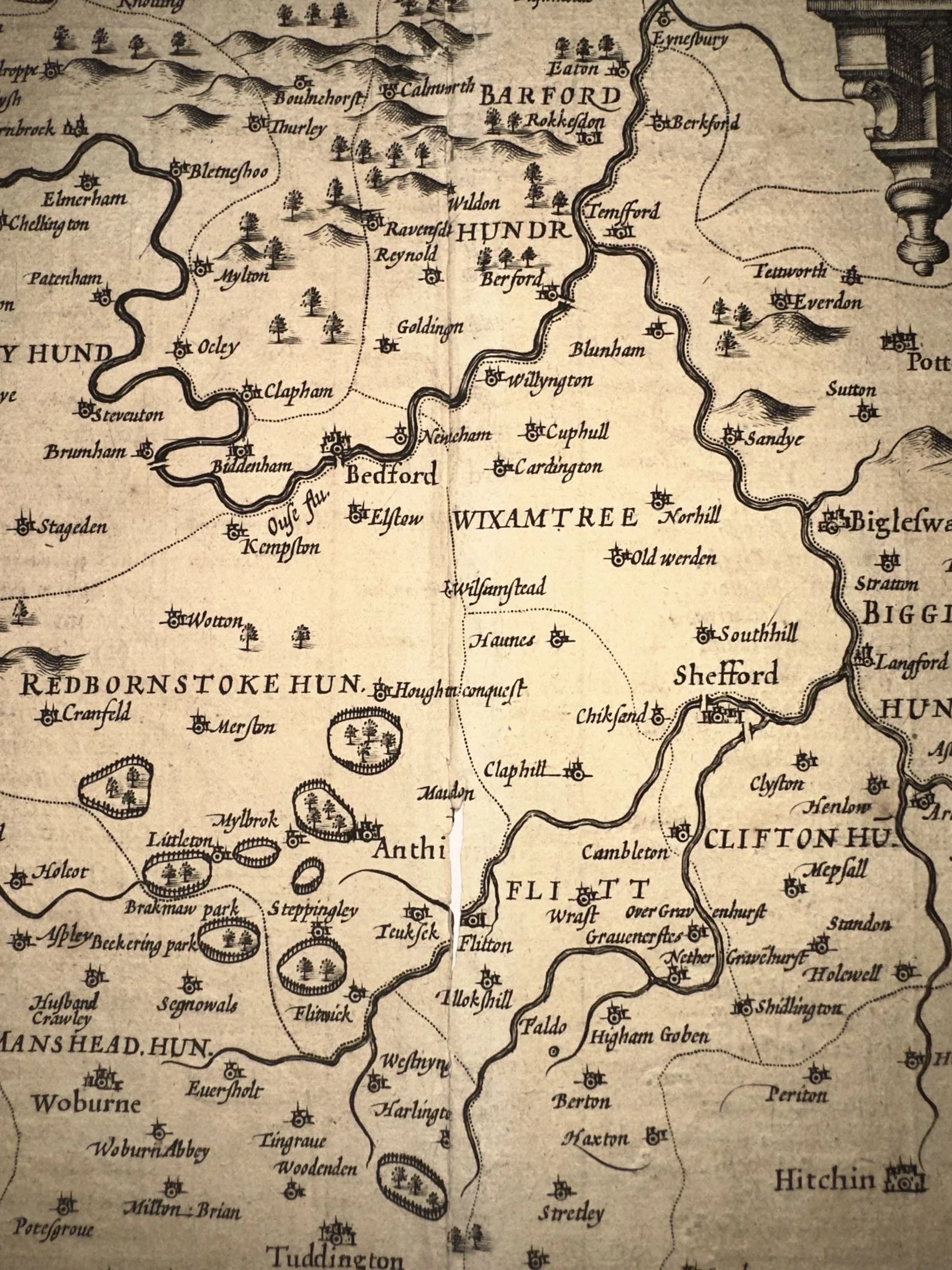
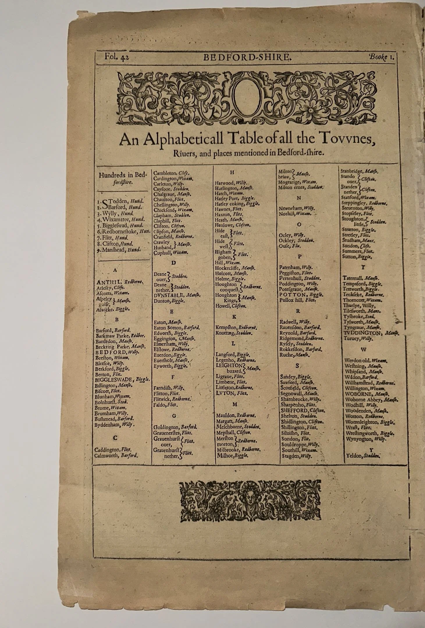
Measuring approximately 23 ½ ”W x 19 ¾”L, this original c. 1680s map of the Caribbean, Florida, Southern US, Central America, and part of South America is in fine condition considering its antique age. Unique for some of its geographical inaccuracies, including the ill placed Mississippi River Valley and fictional mountain range across the North as well as a fictional large lake in where the modern state of Georgia sits. As well as the inclusion of El Dorado on the Lacus Parime in South America. This map has been folded only previously along its original middle crease, where the piece has sustained some water damage and foxing. The bottom right corner and bottom leftmost edge of this map are missing, and there is a small tear in the water of the bottom right corner of the map. There is an additional crease along the middle of the bottom of the map, as well as foxing near the cartouche. Please examine all photos closely before purchasing.
This is an image of the exact map you will receive.
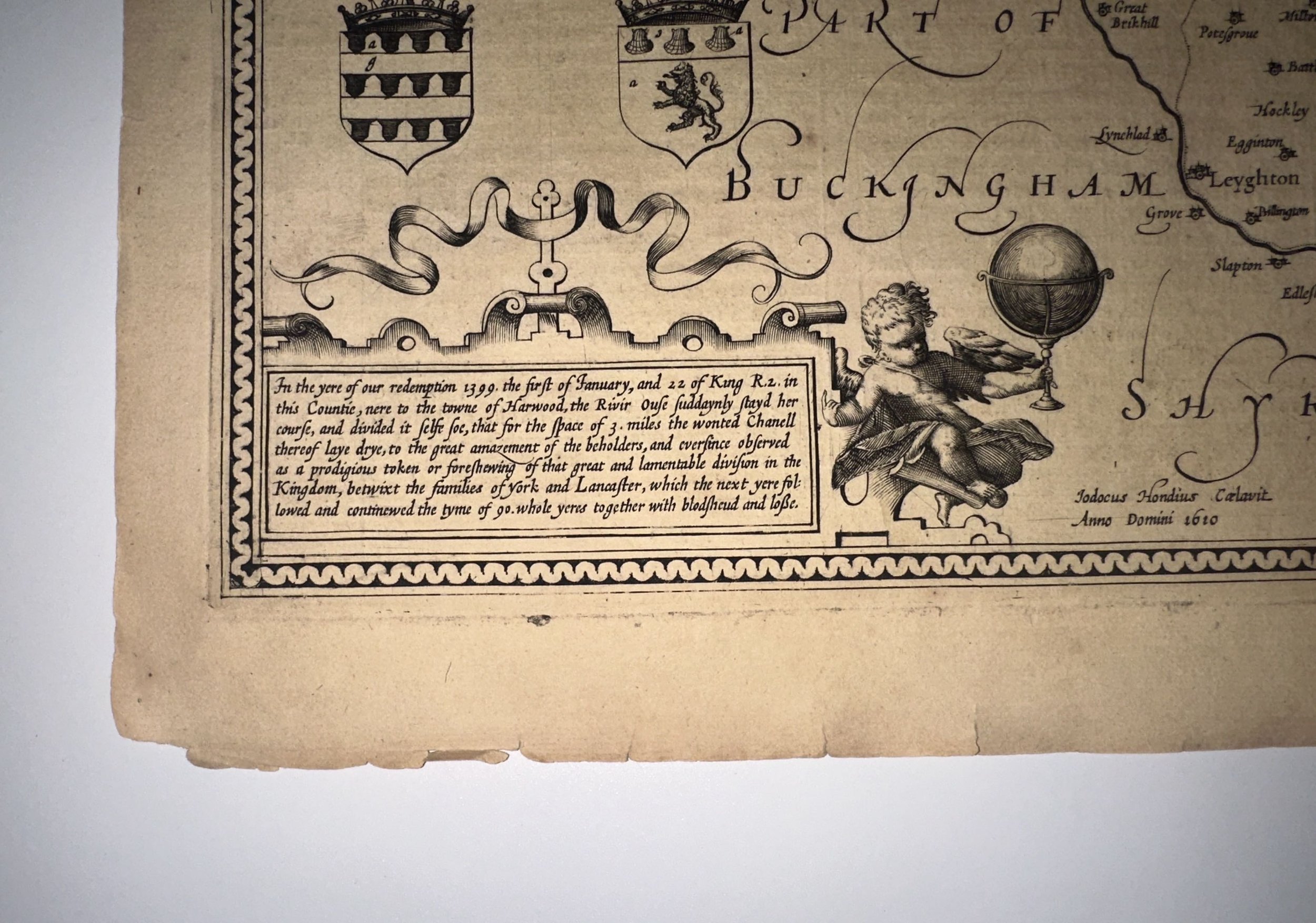
Born in Amsterdam in 1649, Nicolaes Visscher II is the third in a line of prolific printmakers and engravers, following his father Nicolaes Visscher I ( b. January 25, 1618 ) and grandfather Claes Janszoon Visscher (b. 1587). The Visscher work is often regarded as a great early example of Dutch cartography. This map was published circa. 1680. According to some records, this could be a map produced by either Visscher I, or his son of the same name, as it is not confirmed whether or not the former passed away in 1679 or in 1709. It is of our belief that it was created by Visscher II, who joined his father in mapmaking as he grew older and continued producing maps until his own death in 1702. Following Visscher II’s passing, his wife Elisabeth carried on the tradition of mapmaking and publishing. Eventually, their works were sold to Peter Schenk, who would reproduce many of their prints.
All items listed are from V&J Duncan in Savannah, GA. The shop began in 1983 with one tabletop of antique maps and has grown into a vast collection of old engravings, mezzotints, lithographs, photographs, old books, and antique prints. We have prints of architectural interest, birds, animals, botanicals, fashion, sporting scenes and tens of thousands of portraits. Our inventory also includes views and maps of Savannah and other cities, all U.S. states and most countries of the world. Visit us in Savannah, Georgia, or shop inventory here online.
All prints are rolled and shipped in a poster tube. Smaller prints will be shipped in a rigid media mail folder.
Don’t see something you’re looking for? Email or call us to see what we have available!
NICOLAES VISSCHER 1680 Insulae Americanae in Oceano Septentrionali ac Regiones Adiacentes ( The Caribbean, Florida, Southern US Central America, and part of South America ) Original Hand Colored Engraving
Measuring approximately 23 ½ ”W x 19 ¾”L, this original c. 1680s map of the Caribbean, Florida, Southern US, Central America, and part of South America is in fine condition considering its antique age. Unique for some of its geographical inaccuracies, including the ill placed Mississippi River Valley and fictional mountain range across the North as well as a fictional large lake in where the modern state of Georgia sits. As well as the inclusion of El Dorado on the Lacus Parime in South America. This map has been folded only previously along its original middle crease, where the piece has sustained some water damage and foxing. The bottom right corner and bottom leftmost edge of this map are missing, and there is a small tear in the water of the bottom right corner of the map. There is an additional crease along the middle of the bottom of the map, as well as foxing near the cartouche. Please examine all photos closely before purchasing.
This is an image of the exact map you will receive.
Born in Amsterdam in 1649, Nicolaes Visscher II is the third in a line of prolific printmakers and engravers, following his father Nicolaes Visscher I ( b. January 25, 1618 ) and grandfather Claes Janszoon Visscher (b. 1587). The Visscher work is often regarded as a great early example of Dutch cartography. This map was published circa. 1680. According to some records, this could be a map produced by either Visscher I, or his son of the same name, as it is not confirmed whether or not the former passed away in 1679 or in 1709. It is of our belief that it was created by Visscher II, who joined his father in mapmaking as he grew older and continued producing maps until his own death in 1702. Following Visscher II’s passing, his wife Elisabeth carried on the tradition of mapmaking and publishing. Eventually, their works were sold to Peter Schenk, who would reproduce many of their prints.
All items listed are from V&J Duncan in Savannah, GA. The shop began in 1983 with one tabletop of antique maps and has grown into a vast collection of old engravings, mezzotints, lithographs, photographs, old books, and antique prints. We have prints of architectural interest, birds, animals, botanicals, fashion, sporting scenes and tens of thousands of portraits. Our inventory also includes views and maps of Savannah and other cities, all U.S. states and most countries of the world. Visit us in Savannah, Georgia, or shop inventory here online.
All prints are rolled and shipped in a poster tube. Smaller prints will be shipped in a rigid media mail folder.
Don’t see something you’re looking for? Email or call us to see what we have available!

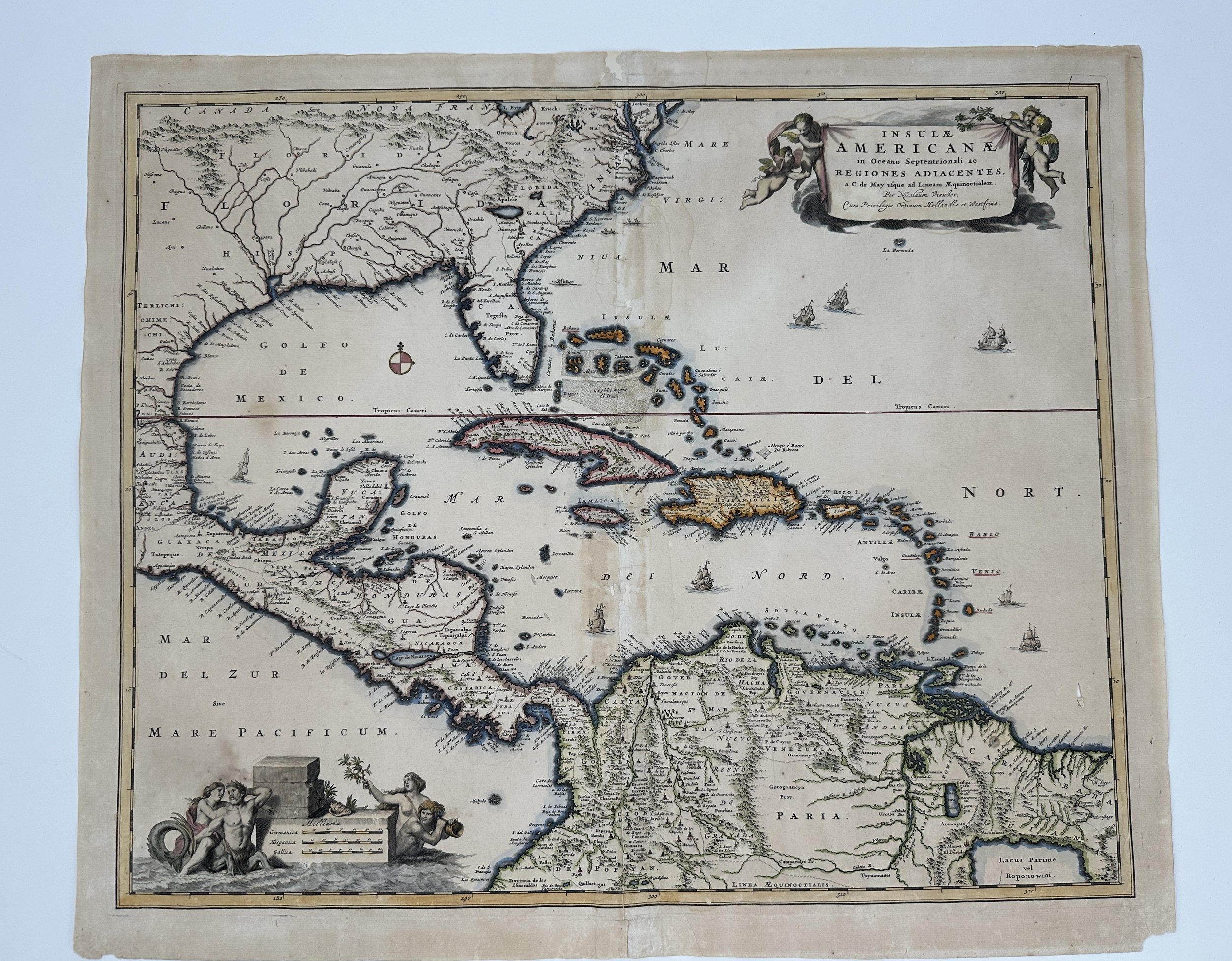 Image 1 of 12
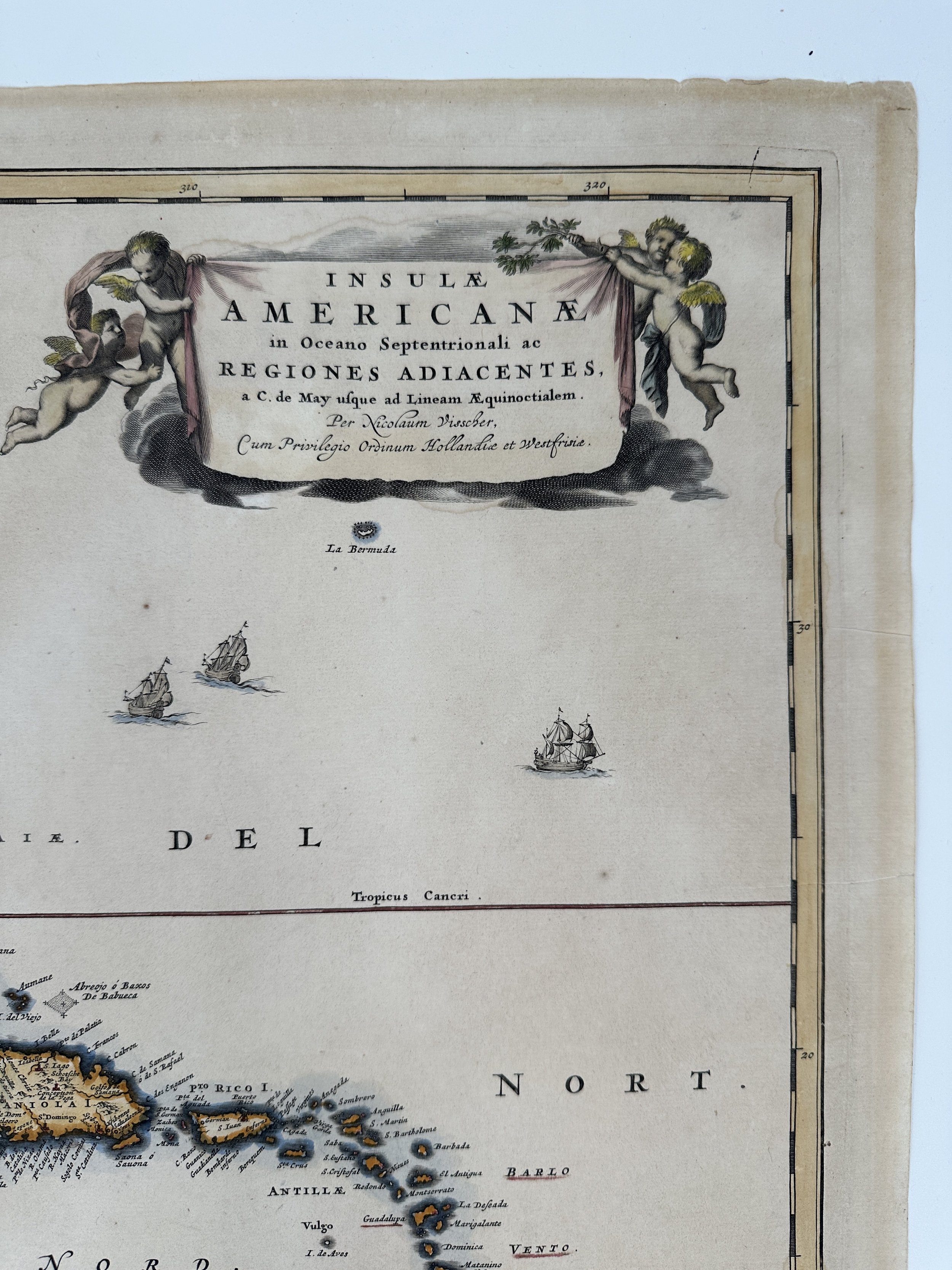 Image 2 of 12
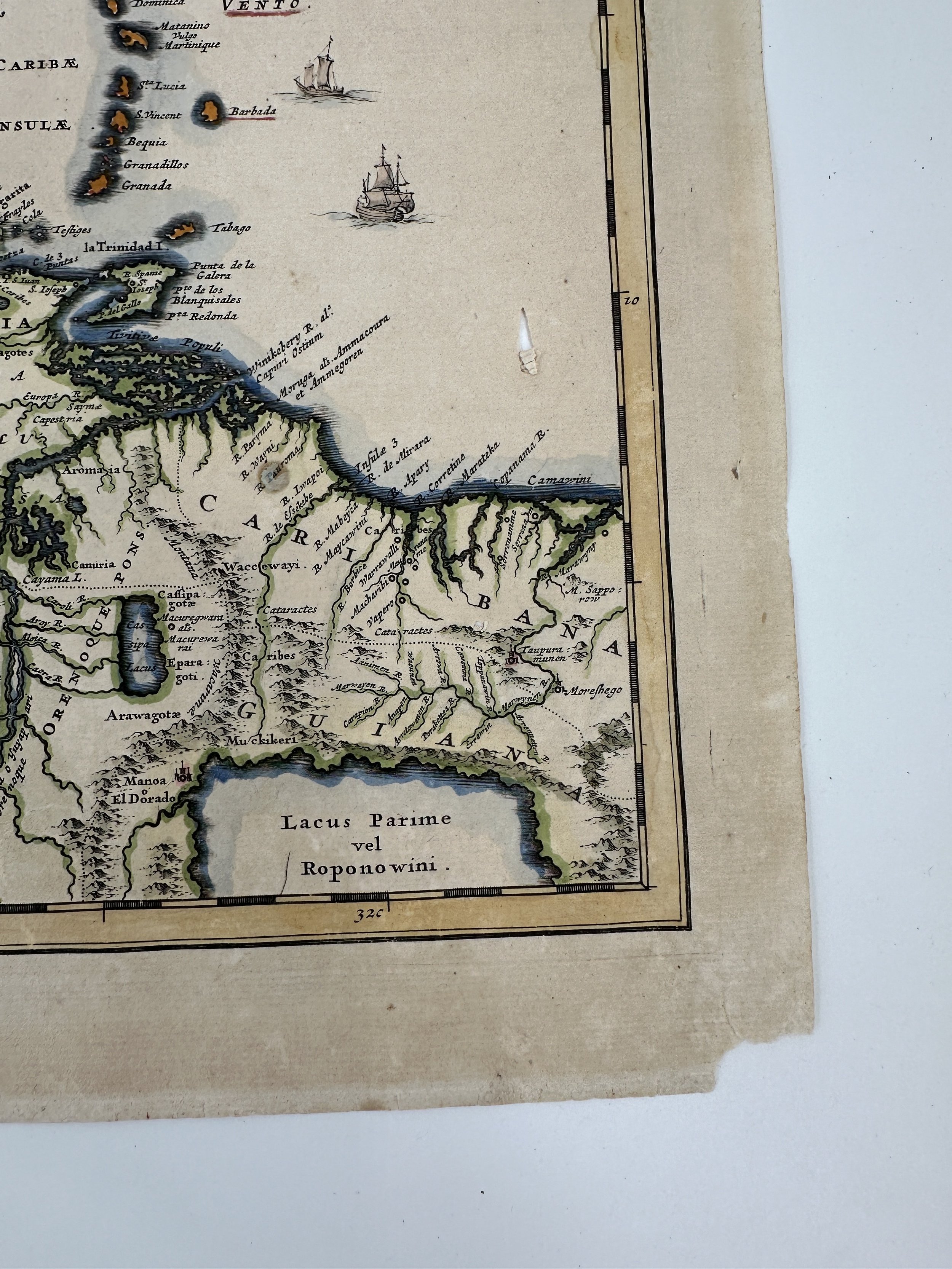 Image 3 of 12
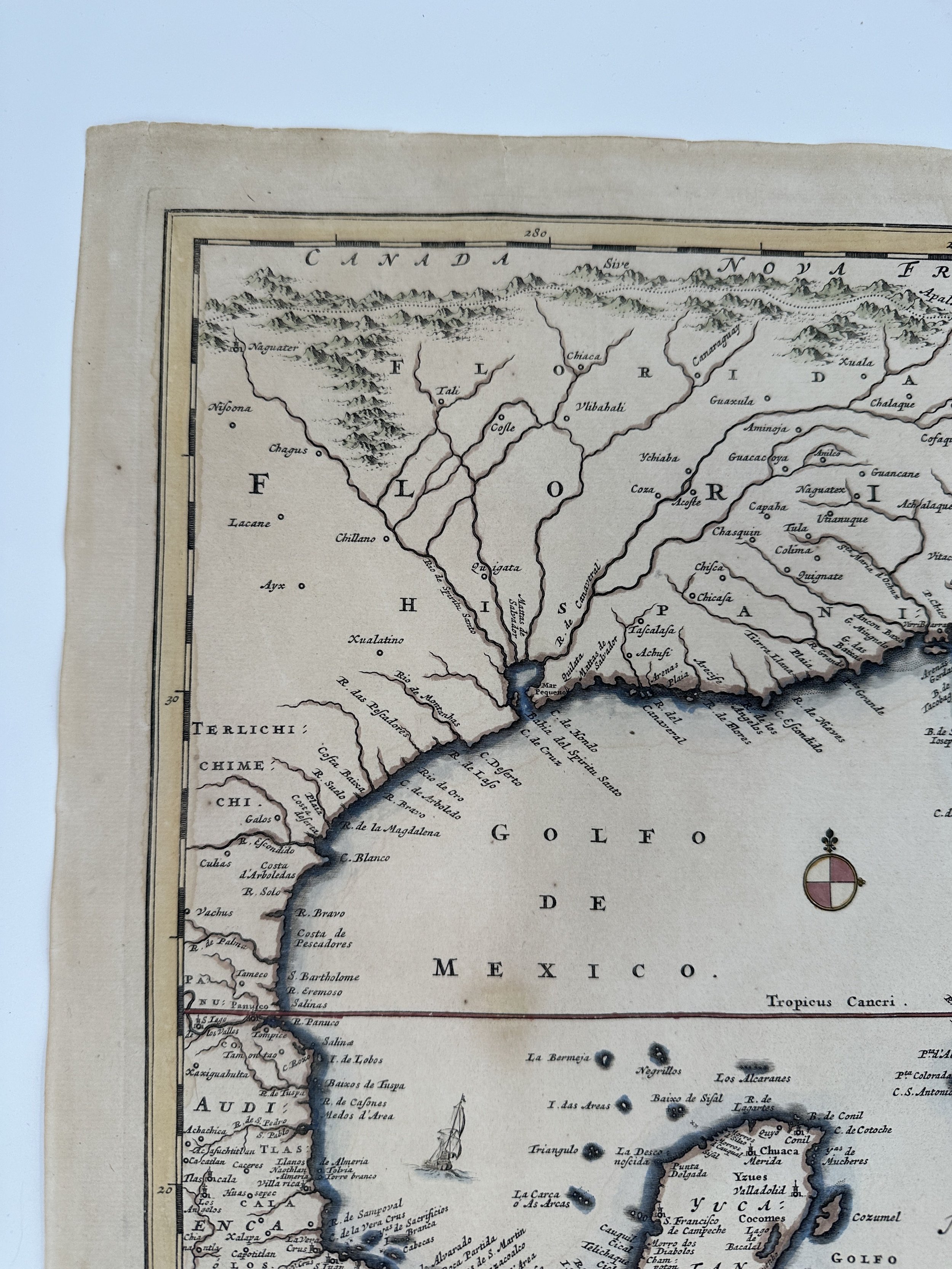 Image 4 of 12
 Image 5 of 12
 Image 6 of 12
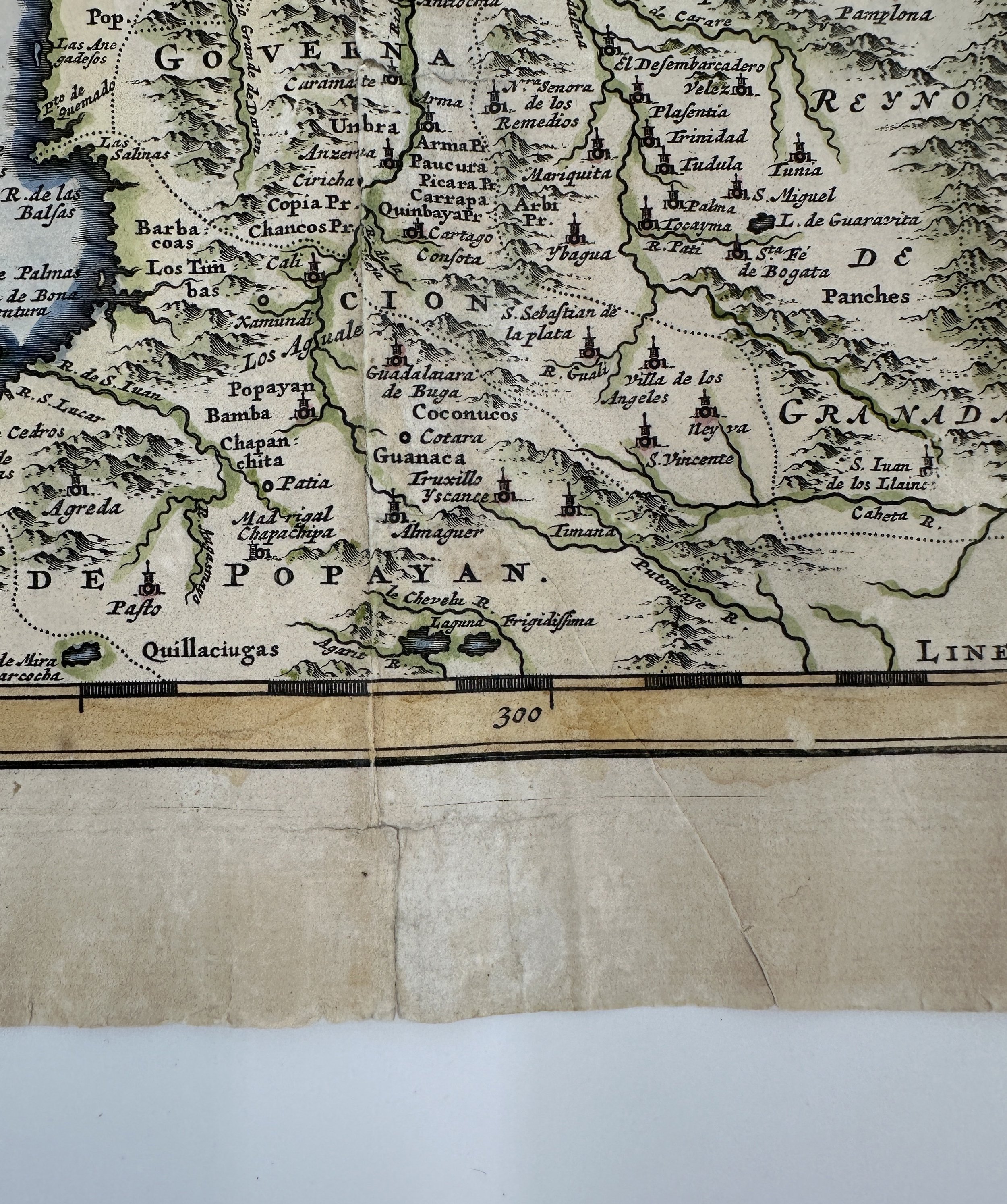 Image 7 of 12
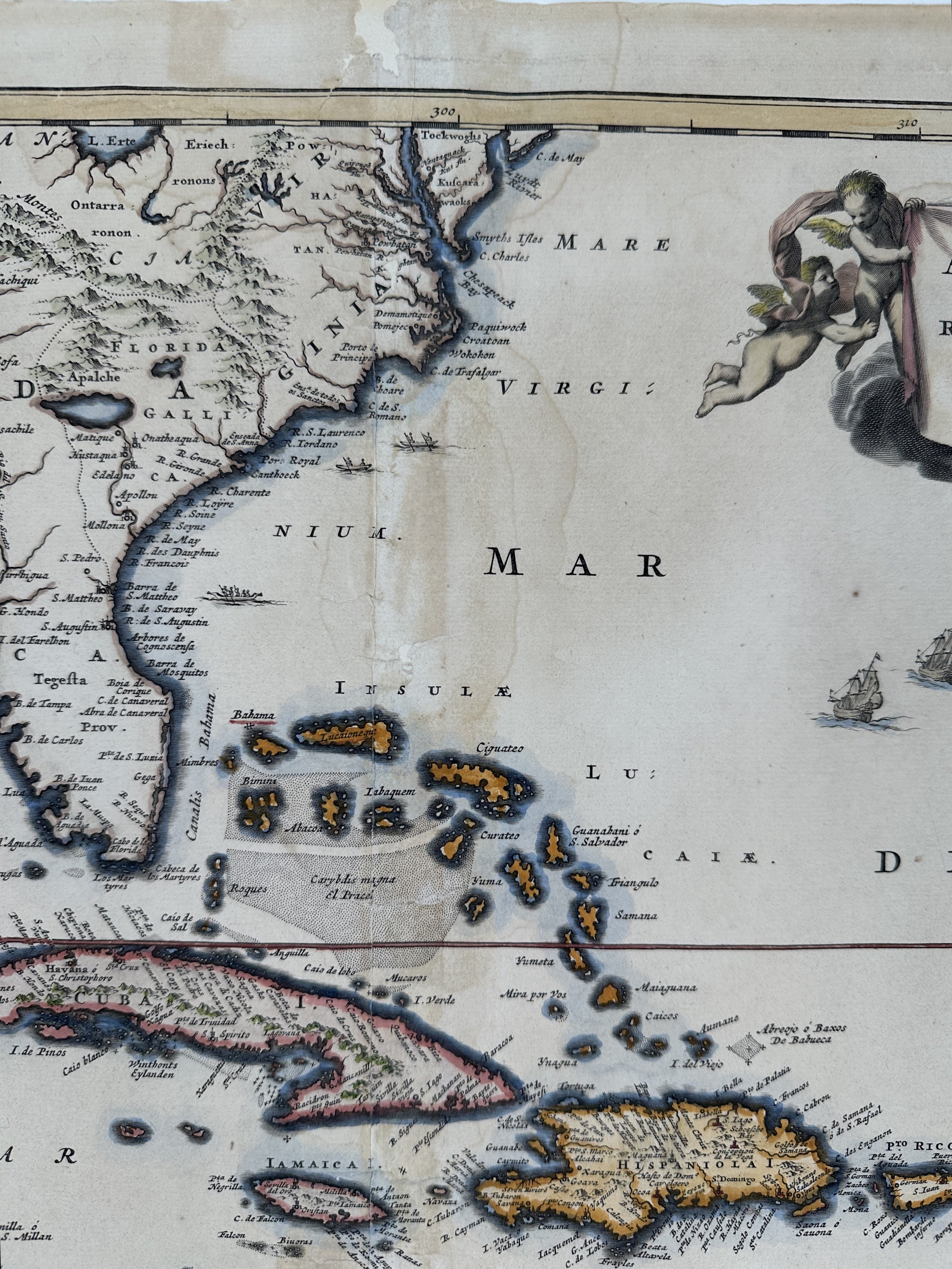 Image 8 of 12
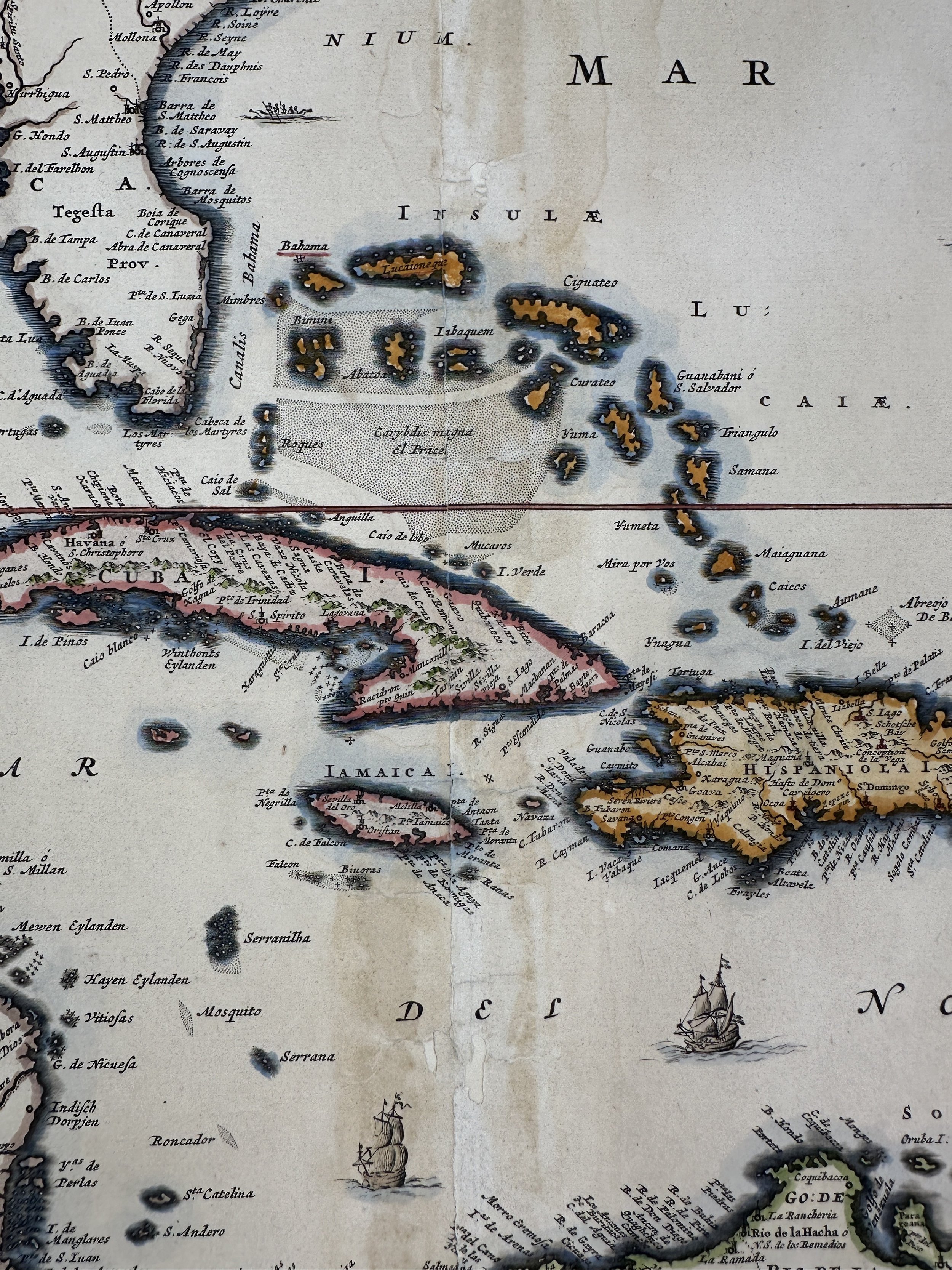 Image 9 of 12
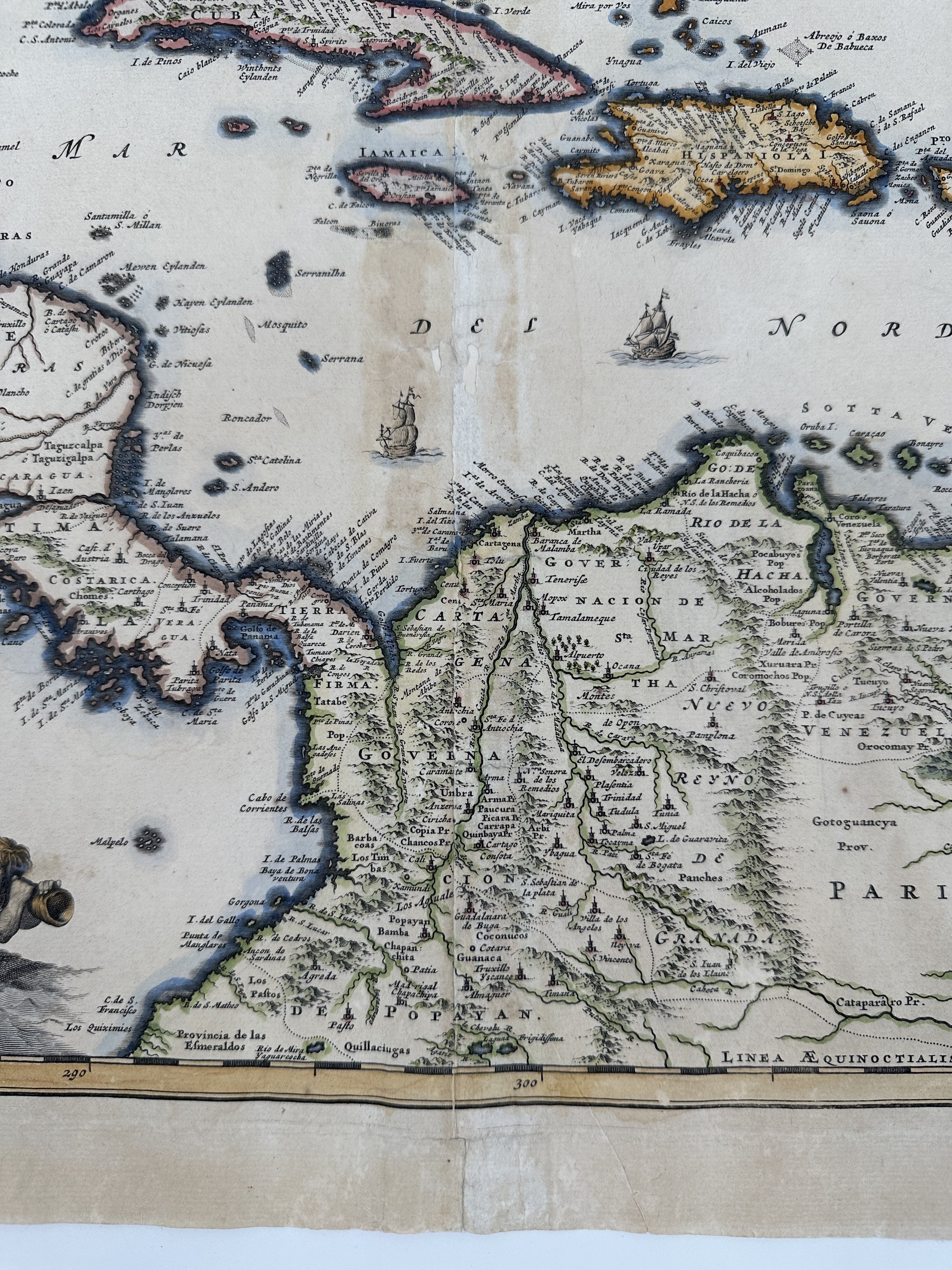 Image 10 of 12
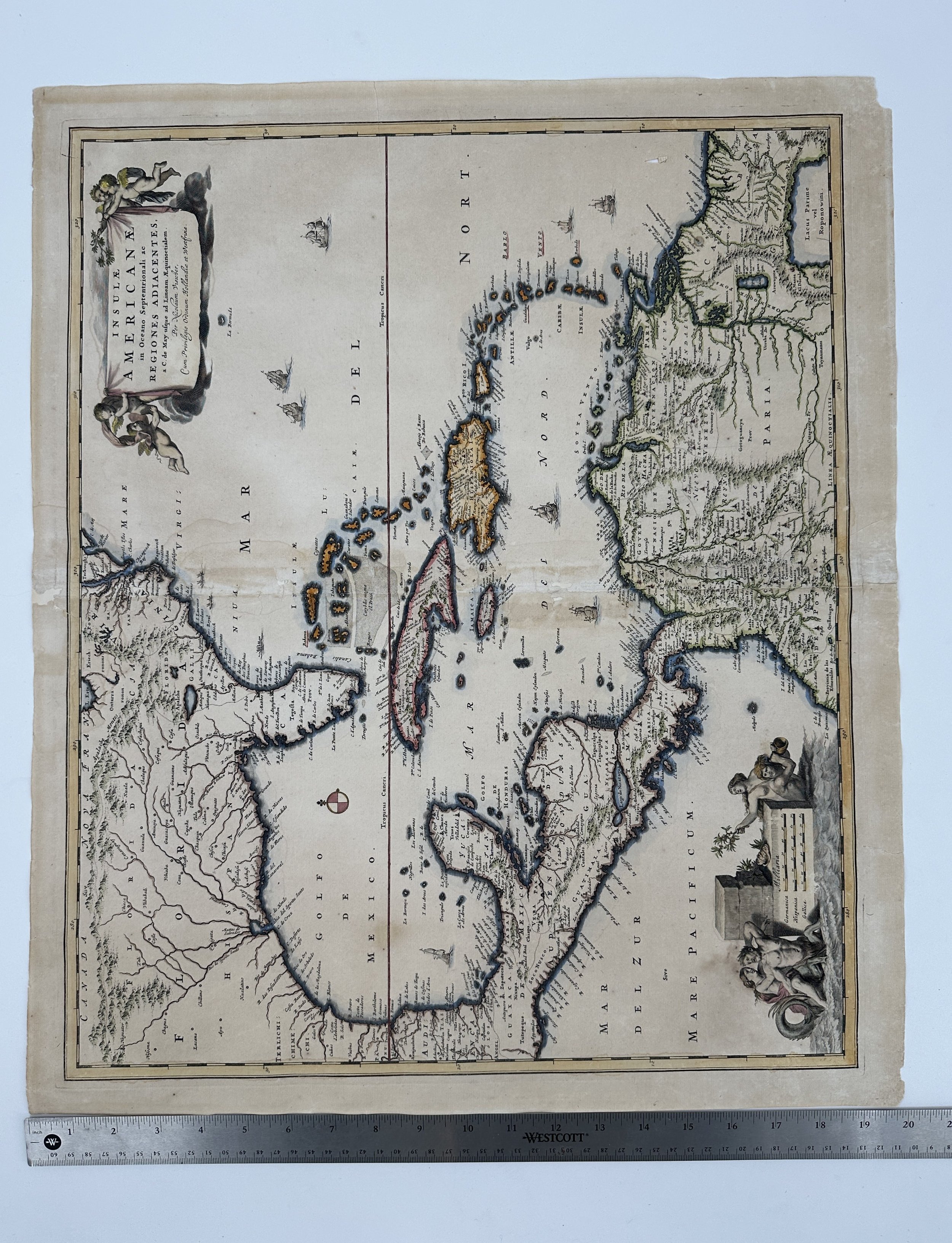 Image 11 of 12
 Image 12 of 12